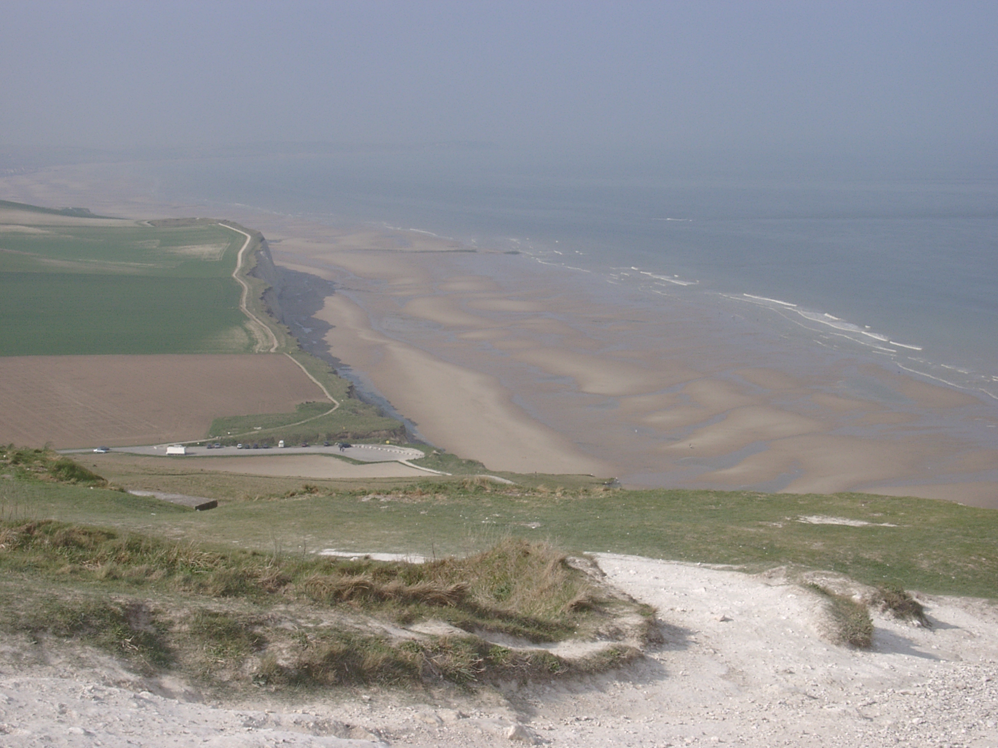
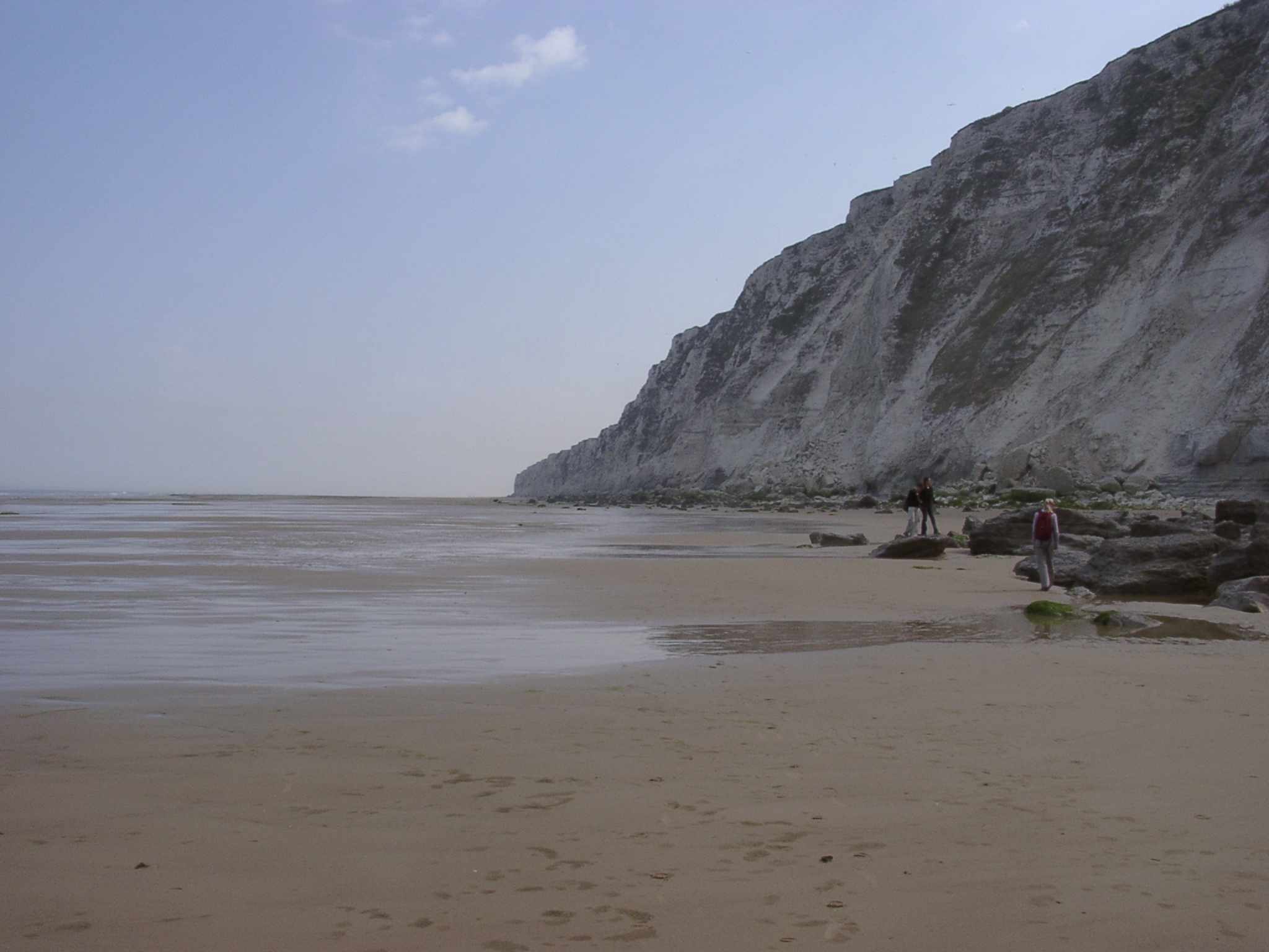
 04220001.JPG 22/04/2003 08:27 Cap Blanc Nez: View southwest towards Le petit Blanc Nez 2 hours before low tide showing extensice sandy foreshore and irregular ridge & runnel topography. |
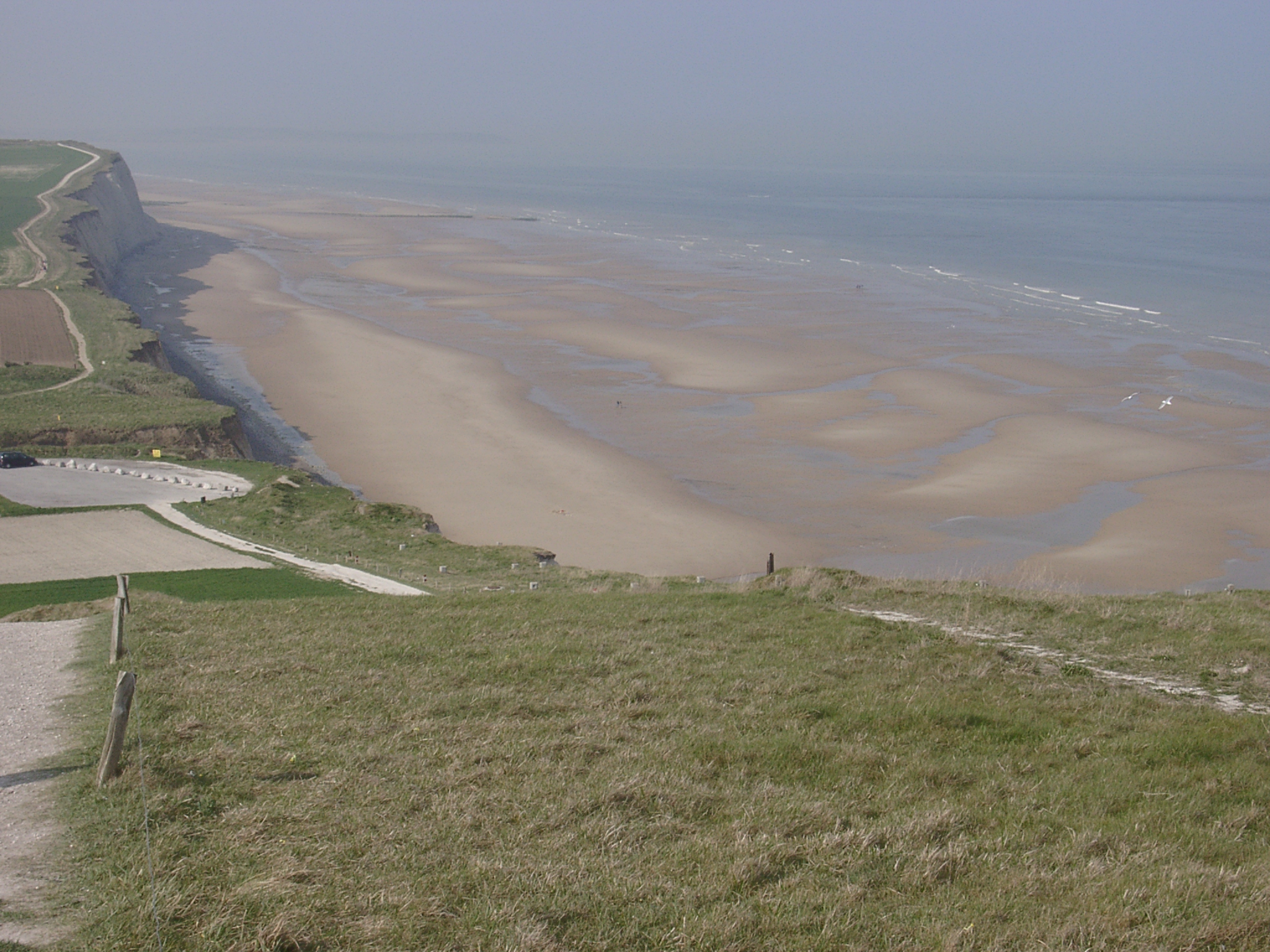 04220002.JPG 22/04/2003 08:33 Cap Blanc Nez: Detailed view southwest towards Le petit Blanc Nez 2 hours before low tide showing extensice sandy foreshore and irregular ridge & runnel topography. |
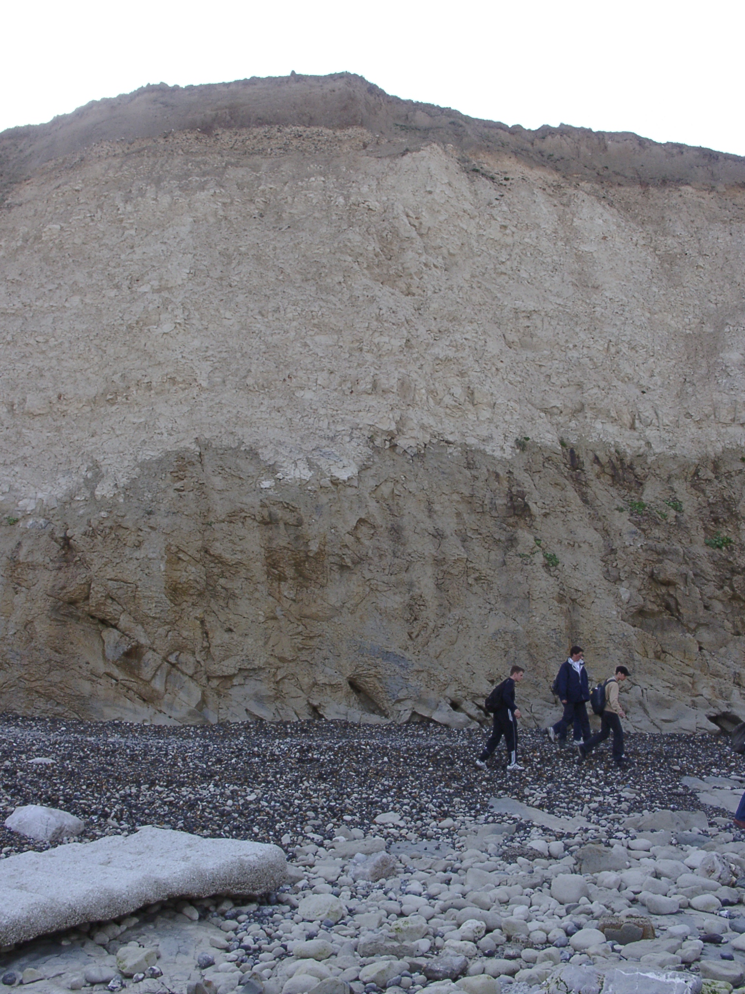 04220003.JPG 26/04/2003 22:07 Cap Blanc Nez: View of cliff face directly west of access at Le Cran d'Escalles. Lower (darker) part of the cliff is moister than the upper part. |
 04220004.JPG 22/04/2003 08:44 Cap Blanc Nez: View northeast along the cliffs from the access at Le Cran d'Escalles. Cliffs are fenced off in the foreground. Large cliff fall debris cones in the background. |
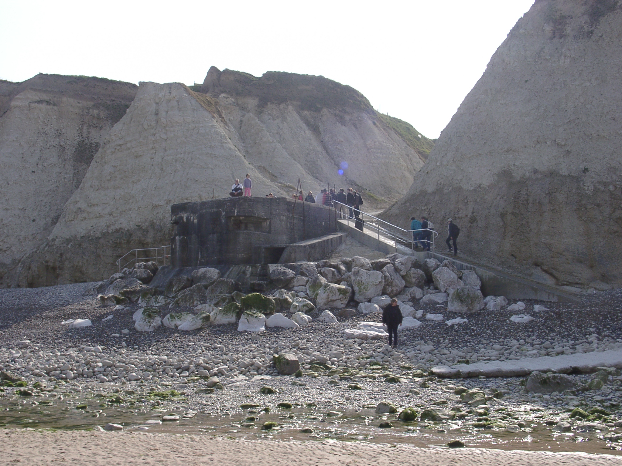 04220005.JPG 22/04/2003 08:48 Cap Blanc Nez: Access steps at Le Cran d'Escalles showing bunker at the bottom of the access. From the position of the bunker it seems that cliff retreat over the past 60 years has been no more than ~10m. Note shingle accumulation is more substantial against the eastern side indicating longshore transport from east to west over the past weeks (annual net longshore transport is from west to east). |
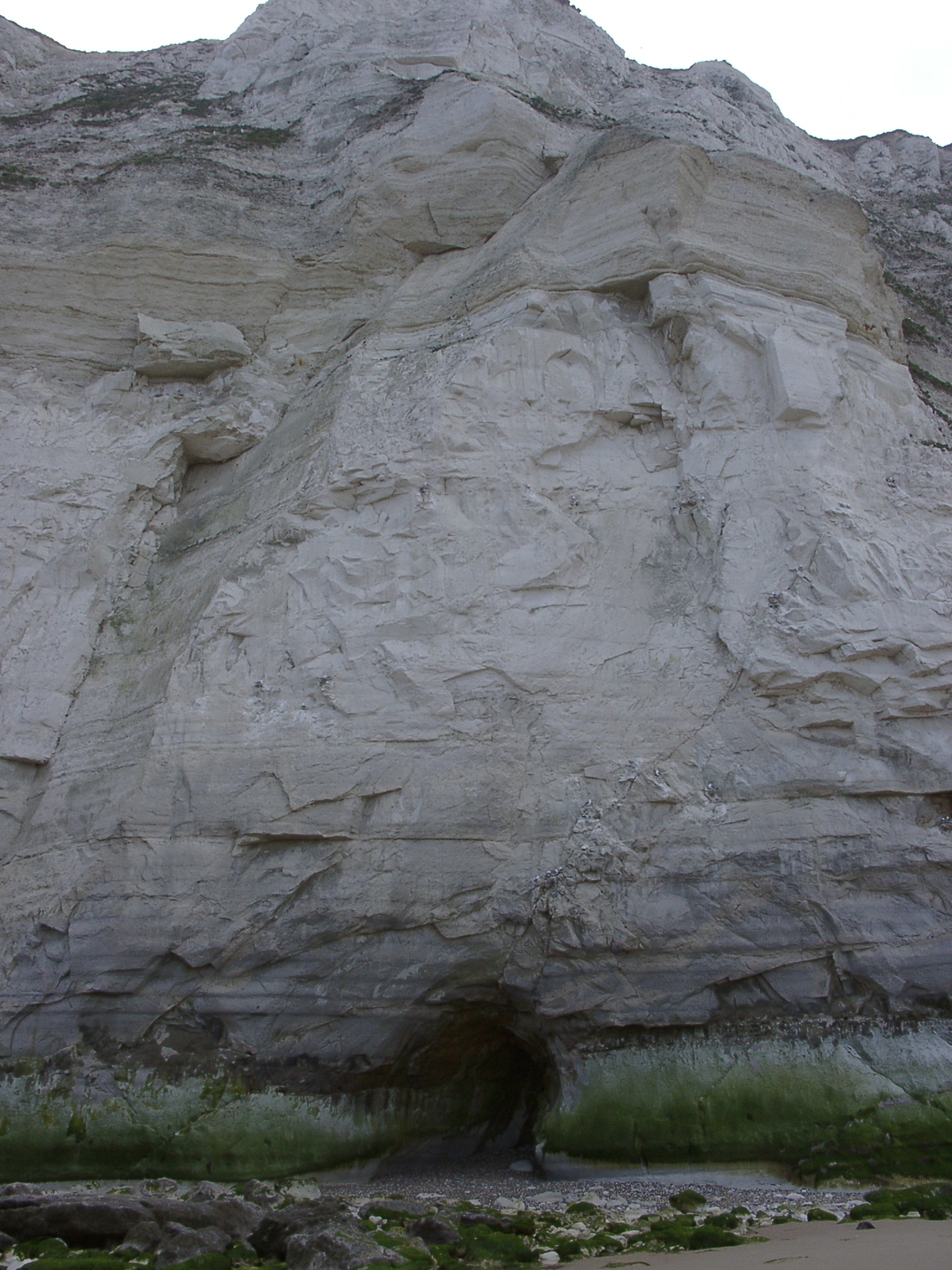 04220006.JPG 26/04/2003 22:07 Cap Blanc Nez: View off the cliff face between the access at Le Cran d'Escalles and Cap Blanc Nez showing variation in geology. |
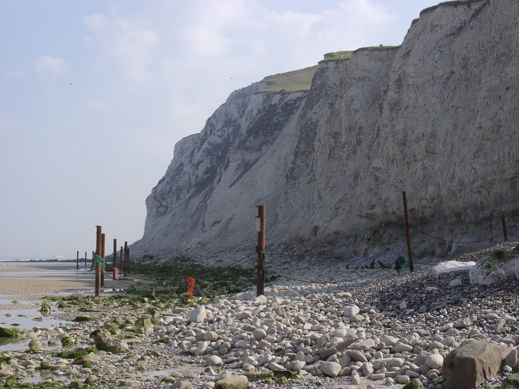
 04220007.JPG 22/04/2003 09:09 Cap Blanc Nez: View northeast along the cliffs from below Cap Blanc Nez showing near vertical chalk cliffs all the way to Sangatte. |
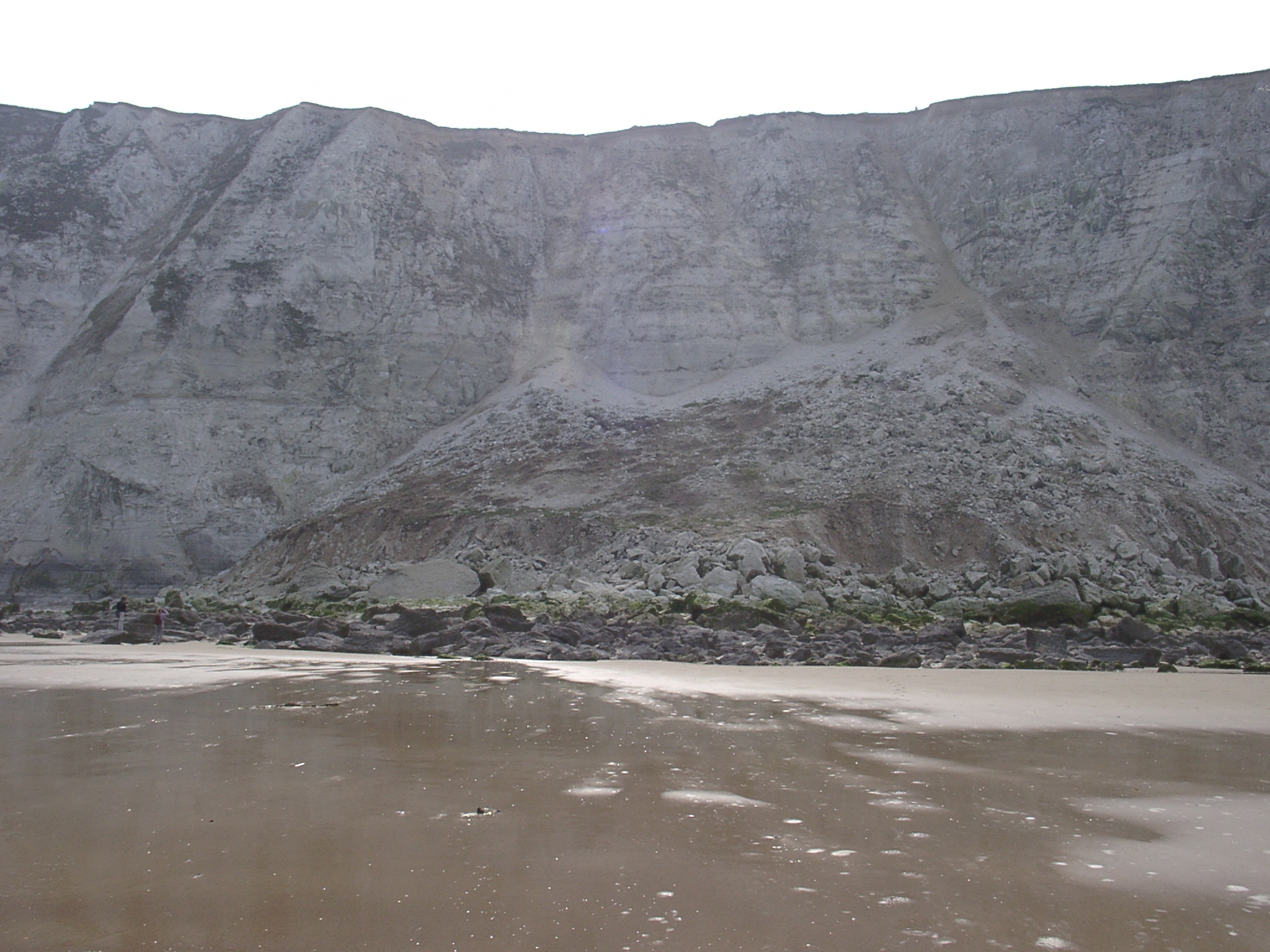 04220008.JPG 22/04/2003 09:09 Cap Blanc Nez: View of the cliffs and cliff fall somewhat east of Cap Blanc Nez. Two persons near the left margin at the foot of the debris cone for scale (cliff height ~100m). |