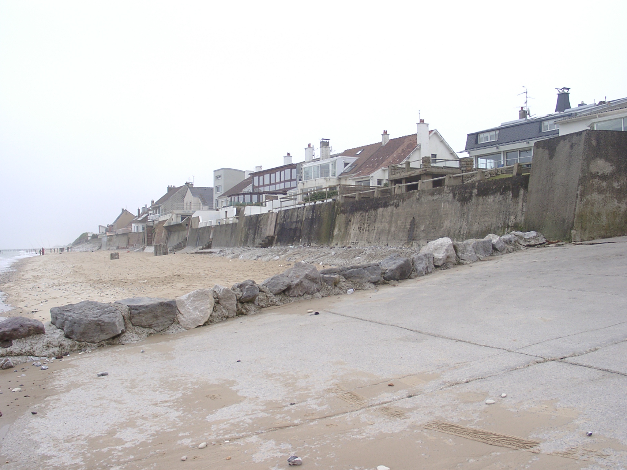
 x: 408837, y: 5641930. View west at Cran d'Escalles at high tide towards le Petit Blanc Nez. Flint shingle beach is banked against blockhouse at the foot of the cliff. |
 x: 408785, y: 5641908. View east from top of blockhouse at Cran d'Escalles at high tide. The is a much samller flint shingle beach banked against blockhouse at the foot of the cliff. |
 x: 408785, y: 5641908. View west from top of blockhouse at Cran d'Escalles at high tide towards le Petit Blanc Nez. Flint shingle beach is banked against blockhouse at the foot of the cliff. Debris of older access steps can be seen in the foreground. |
 x: 408785, y: 5641908. Composition of the western beach at Cran d'Escalles. Notebook is 14.5 x 11cm. |
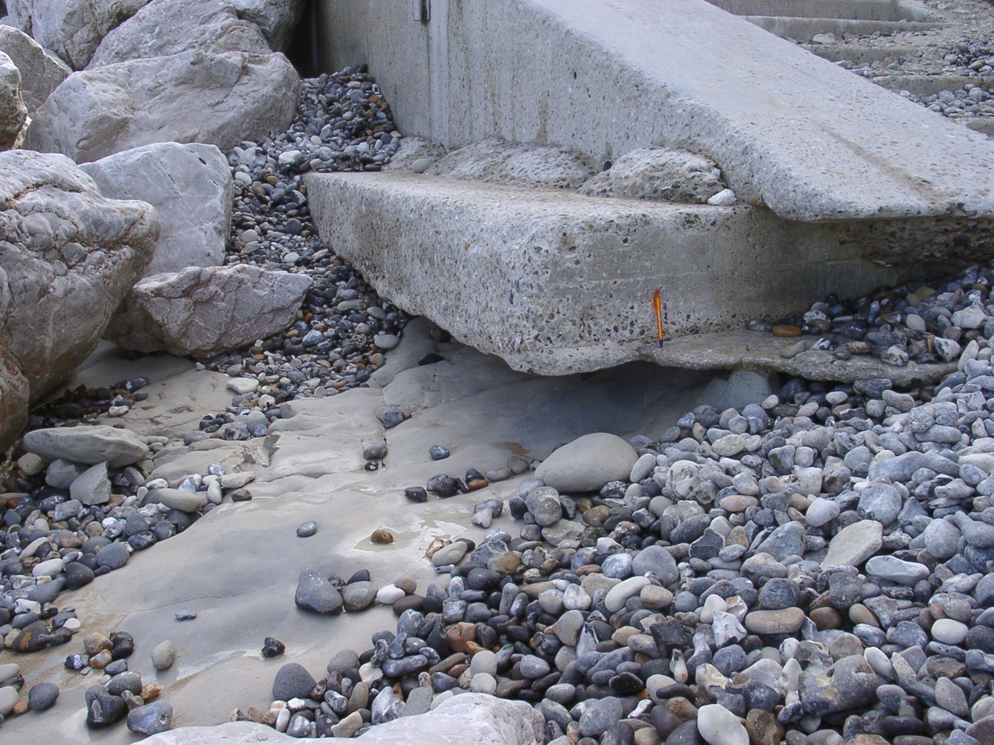 x: 408785, y: 5641908. Illustration of the undermining of the foundation of the western access steps. Ball pen is 14cm long. |
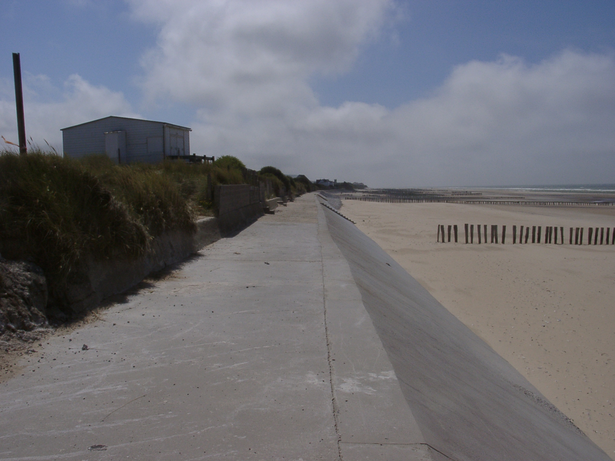
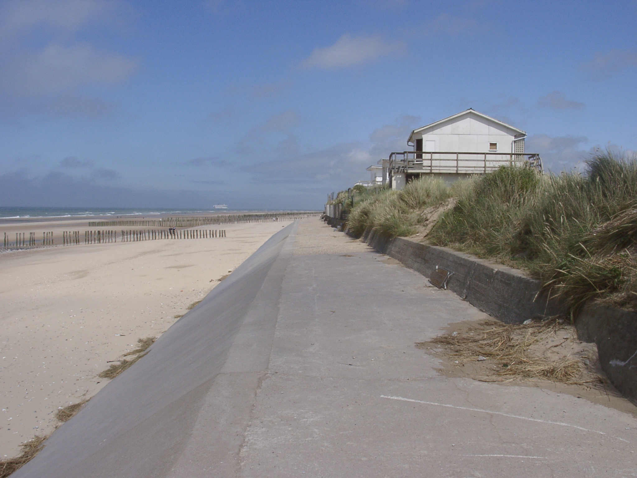
 x: 411646.538, y: 5644259.676. Beach access at the western end of Sangatte looking east along variety of privately built sea walls. Small shingle storm beach to the east of the slip way. |
 x: 411855.879, y: 5644371.234. Damage to the sloping seawall in front of the private property showing concrete plug from previous repair attempts plus a variety of other repairs. Only sand was visible in the hollow created. GPS is 11cm. |
 x: 411855.879, y: 5644371.234. Look east along disfunct wave screen with remaining groyne pile in the background. GPS at the toe of wave screen pile in 11cm long. Abrasion pattern suggest that sand levels have been at the present level for a long time. |
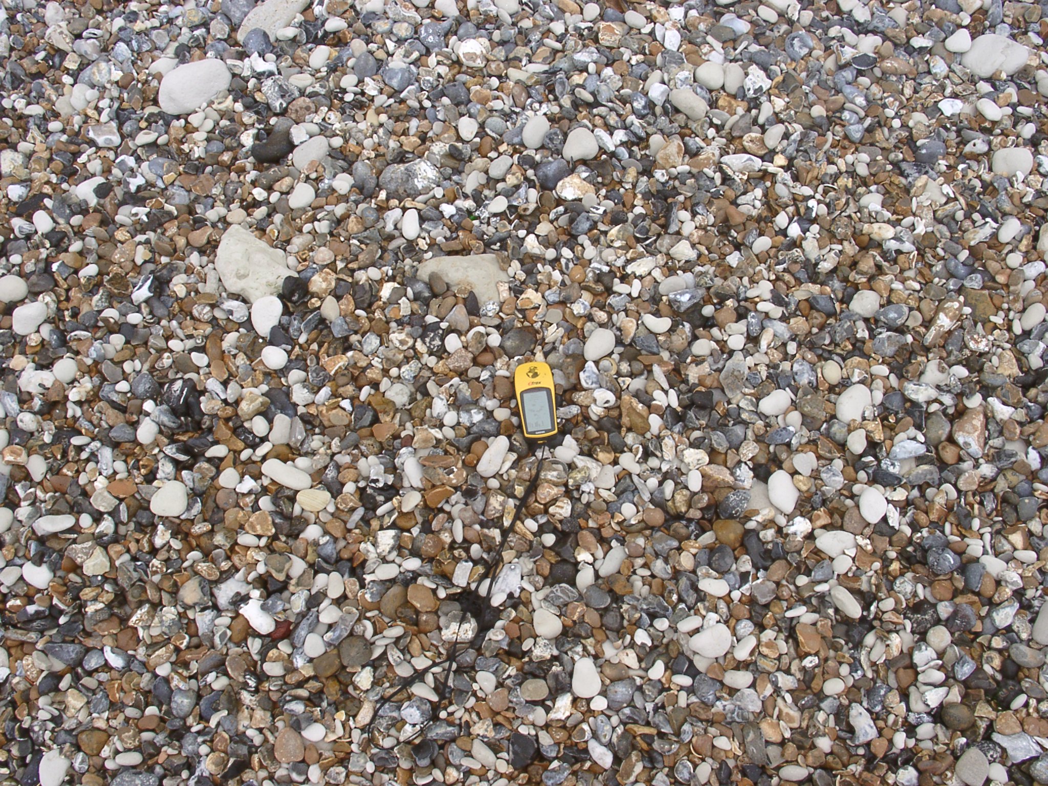
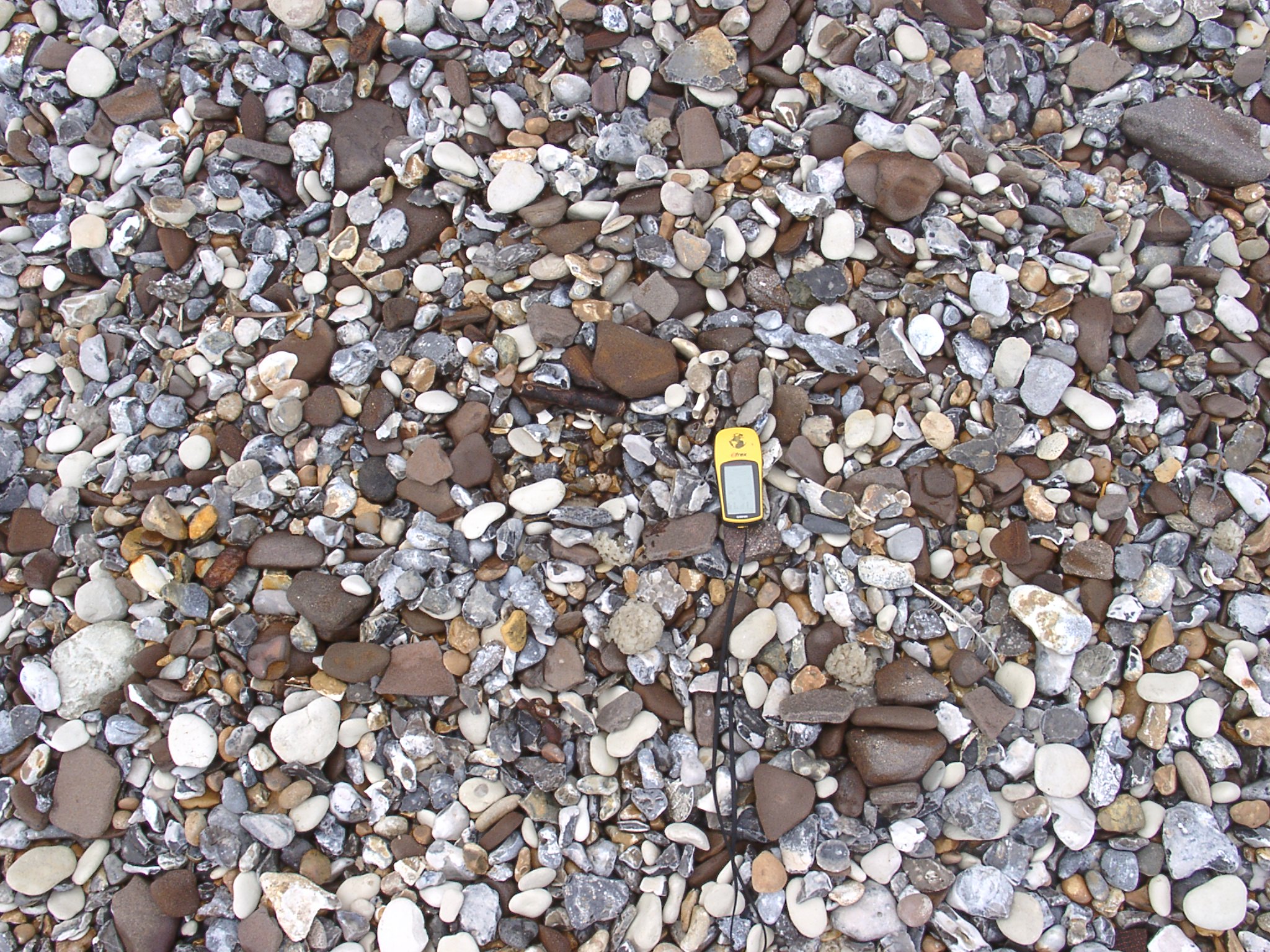 x: 411646.538, y: 5644259.676. Shingle beach east of the slip way composed of both angular / broken and well rounded flint plus brown sandstone discs and more restistan chalk pebbles. GPS is 11cm long |
 x: 411747.171, y: 5644313.465. Illustrations of private seawall construction east of the slipway, partly protected by shingle beach. |
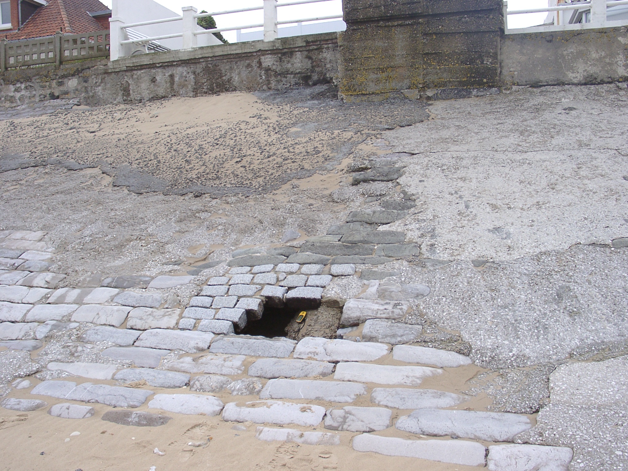
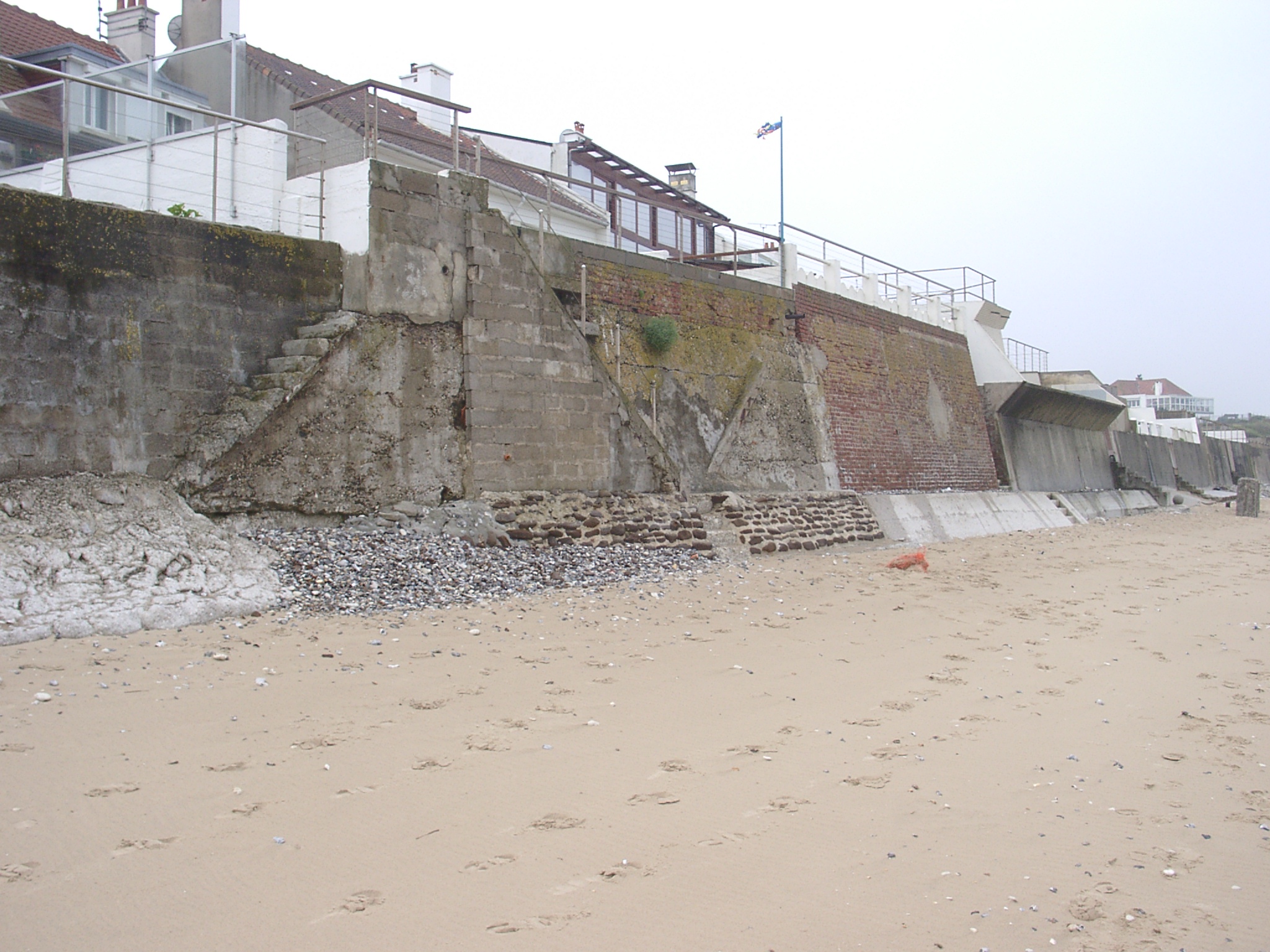 x: 411747.171, y: 5644313.465. Illustrations of private seawall construction east of the slipway. Various stages of access steps in disrepair and fortifications of the sewall toes. |
 x: 411506, y: 5644198. View of the natural cliff west of the slipway. Storm berm consists mainly of shingle and is separated from the lower beach by a s~0.5m high step (used by person in the background as a seat). |
 x: 411506, y: 5644198. Detailed view of the storm berm showing some seakale in the foreground. A sheet of sand is partly covering the lower bart of the almost horizontal storm berm. |
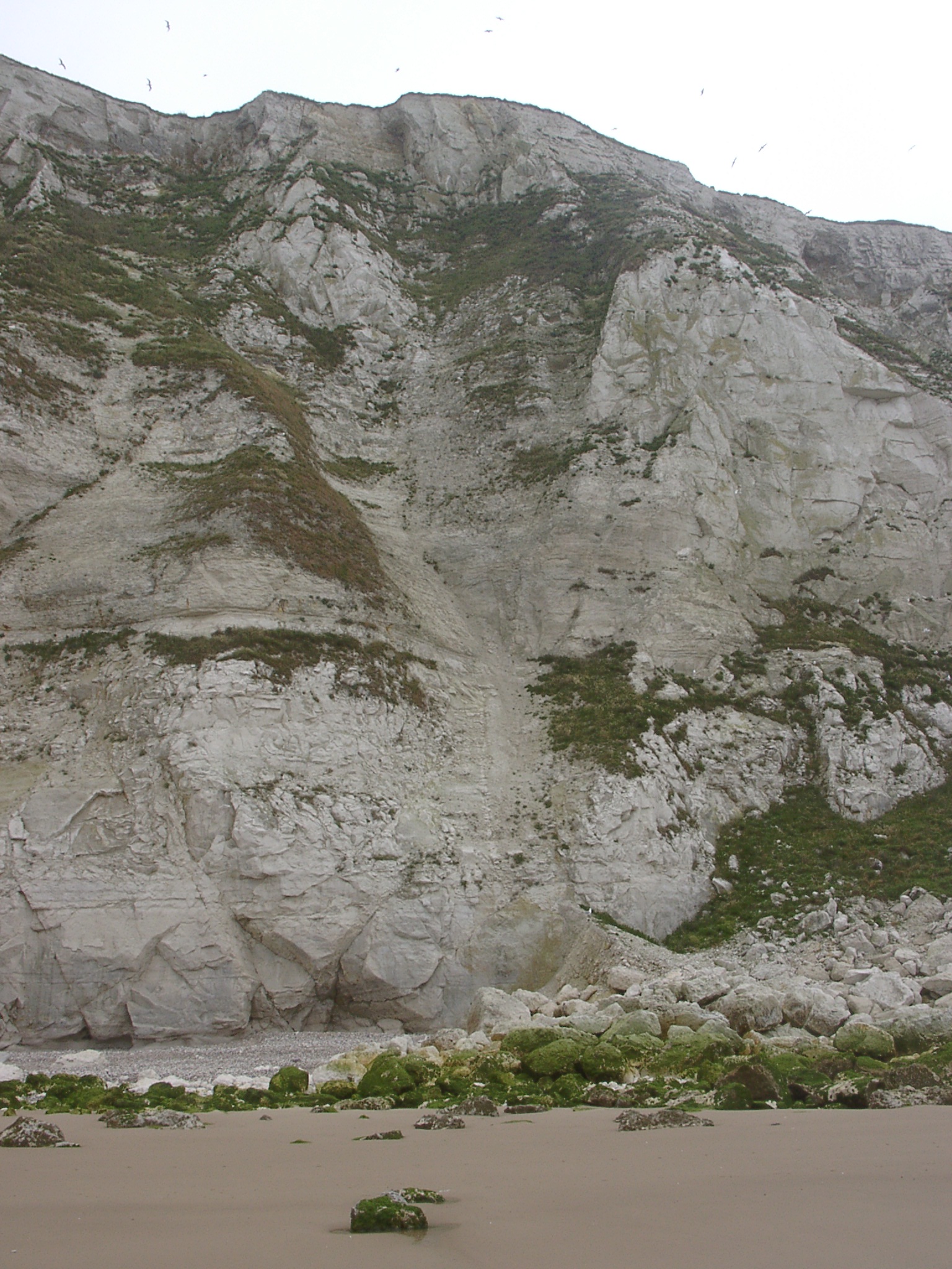
 x: 411506, y: 5644198. Section of cliff showing abundance of broken flints in this periglacial slope deposit. GPS in centre is 11cm long. |
 x: 411506, y: 5644198. Detail of section of cliff showing abundance of broken flints in this periglacial slope deposit. GPS in centre is 11cm long. |
 x: 411470, y: 5644198. Section of cliff showing vallley infill. |
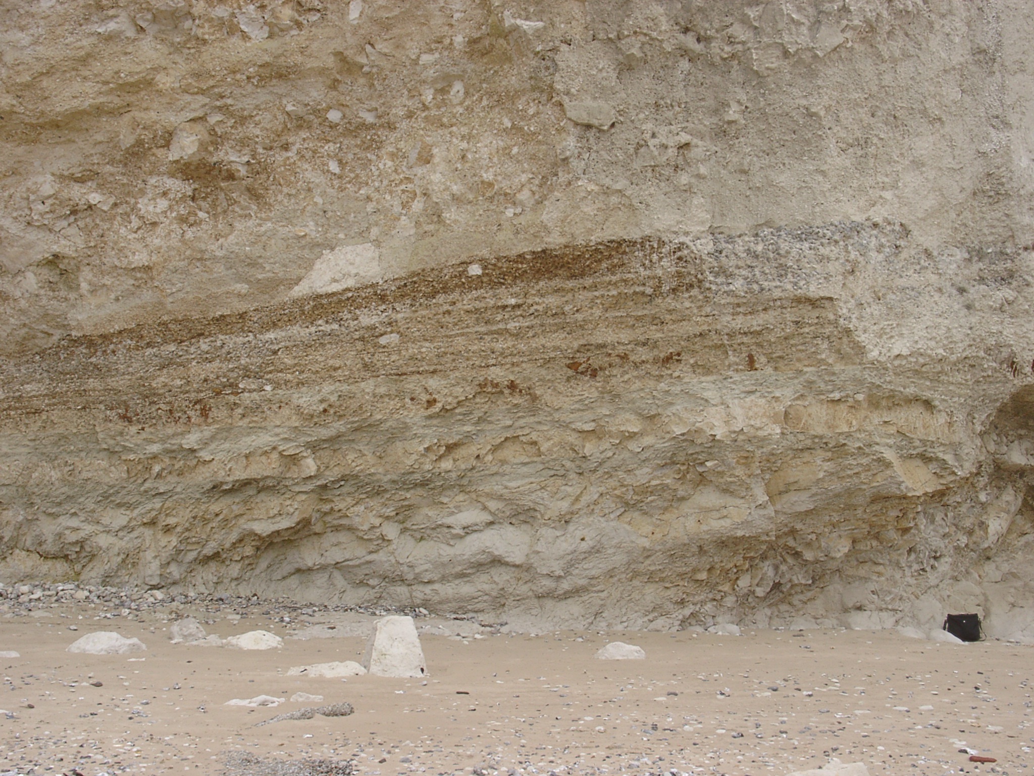
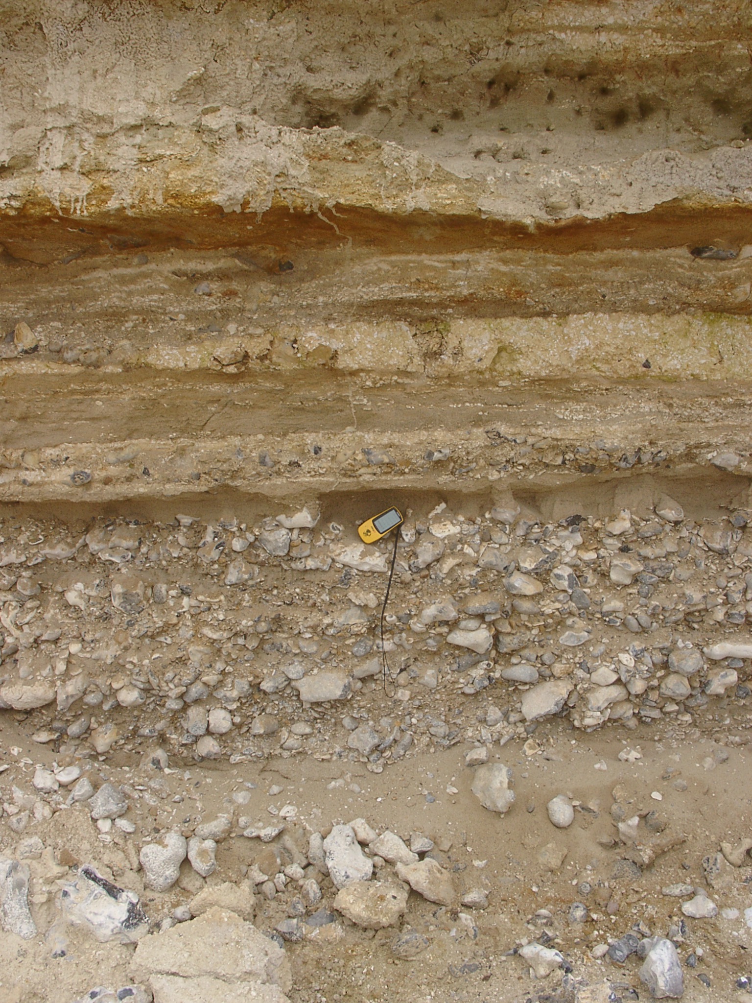
 x: 411392, y: 5644115. Section of cliff showing in the lower part sub-hoizontal layers of silty sand alternating with more heterogeneous matirial inclusind chalk fragments. GPS in centre is 11cm long. |
 x: 411392, y: 5644115. Detail of section of cliff showing in the lower part sub-hoizontal layers of silty sand alternating with more heterogeneous matirial inclusind chalk fragments. GPS in centre is 11cm long. |
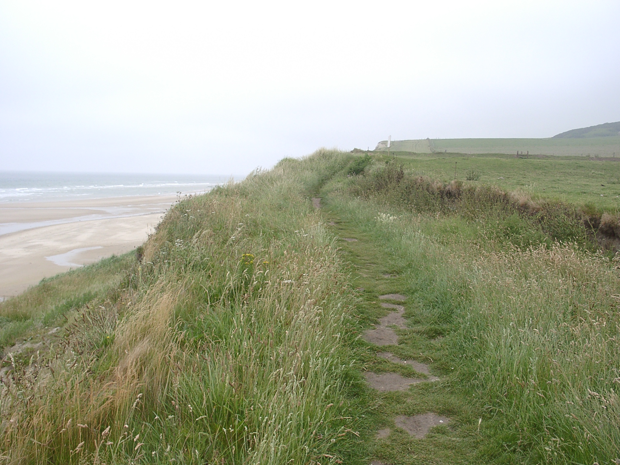
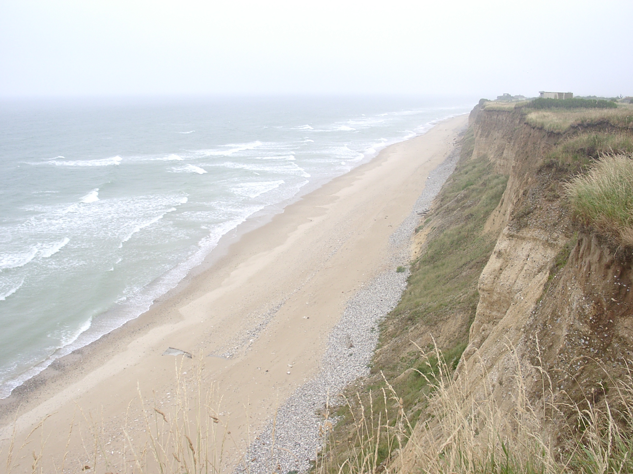 x: 410980, y: 5643841. View east along the cliffs west of Sangatte showing the cliff toe deposits, narrow upper storm berm composed of shingle, oblique wave approach and offshore breaking of waves over most landward intertidal ridge. |
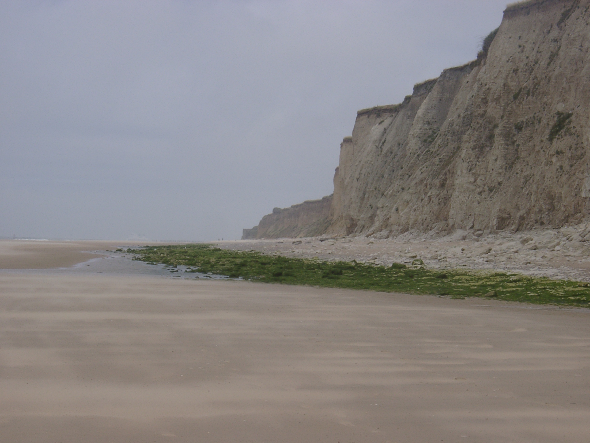
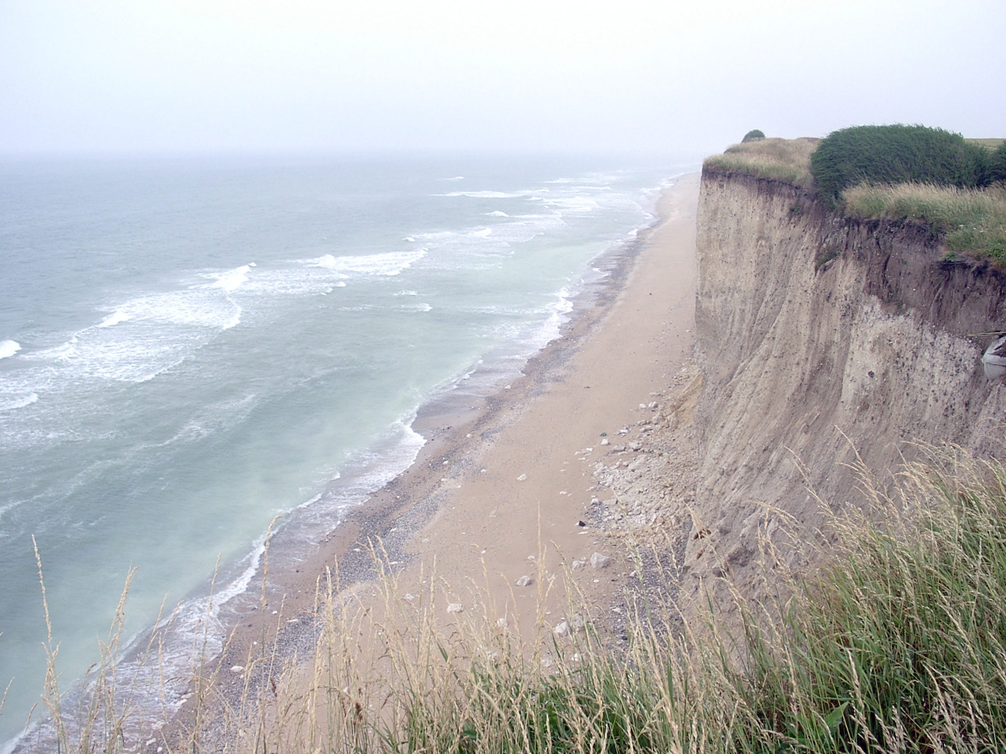 x: 410723, y: 5643694. View east along the cliffs showing the absence of a cliff toe deposits and storm berm. Instead cliff is almost vertical and undercut . |
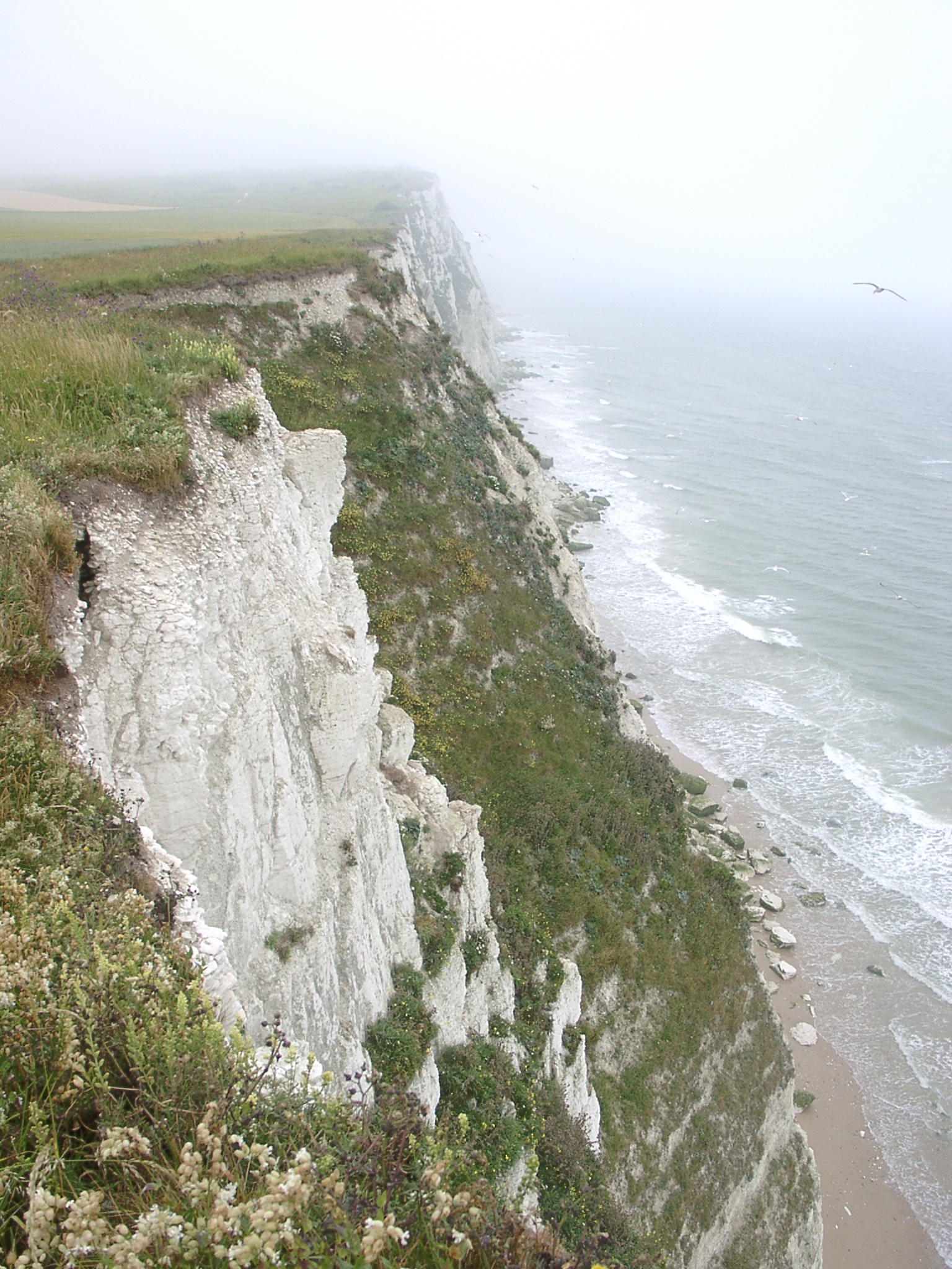 x: 410330, y: 5643370. View west along the cliffs showing the densly vegetated chalk cliffs. |
 x: 410099, y: 5643166. View west along the cliffs showing some shallow valley infill at the top of the cliff. |
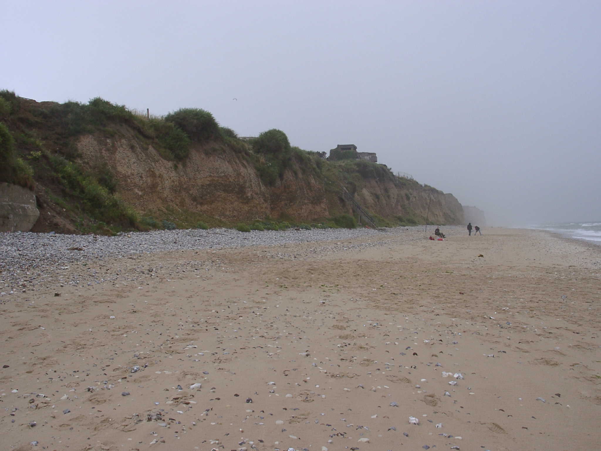
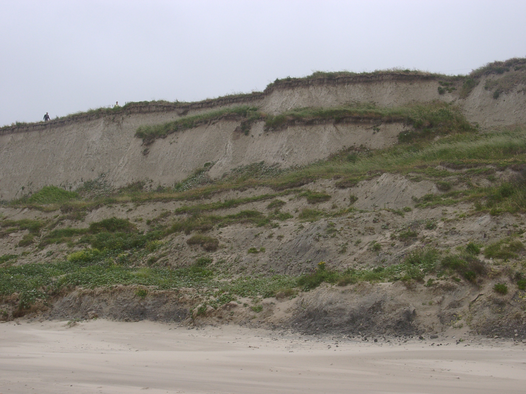
 x: 409619, y: 5642751. View west along the cliffs showing the well vegetated slope and slope deposit of major cliff fall. There is a very small amount of shingle at the intersection between the cliff fall debris and the cliff toe. |
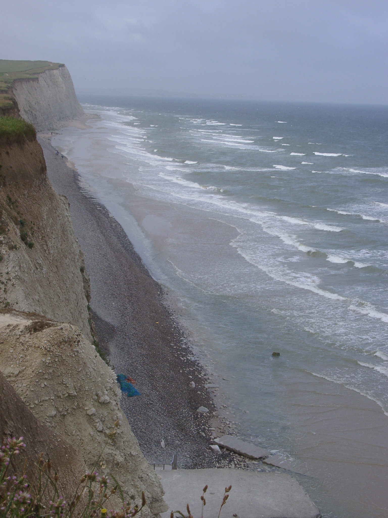
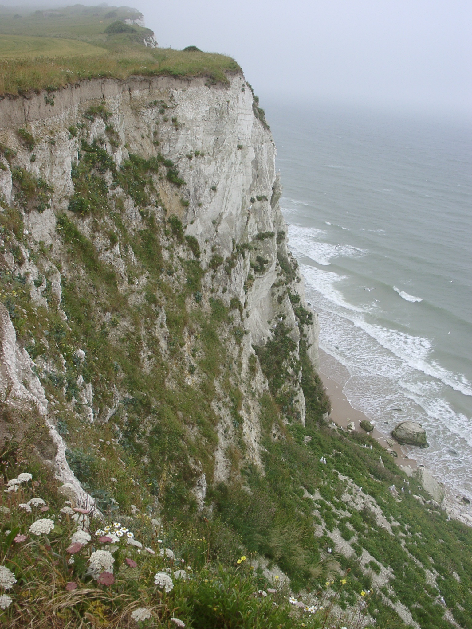
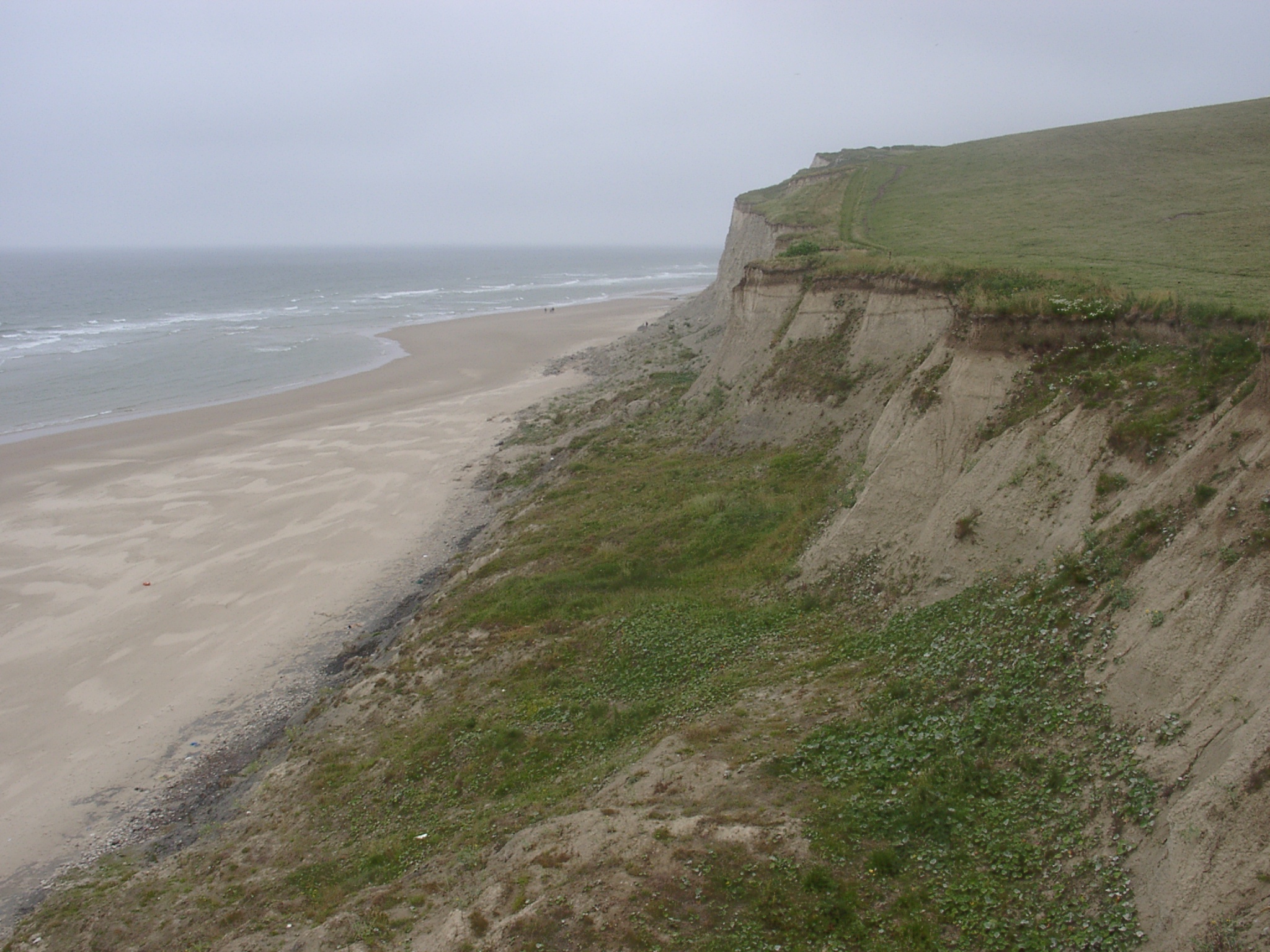
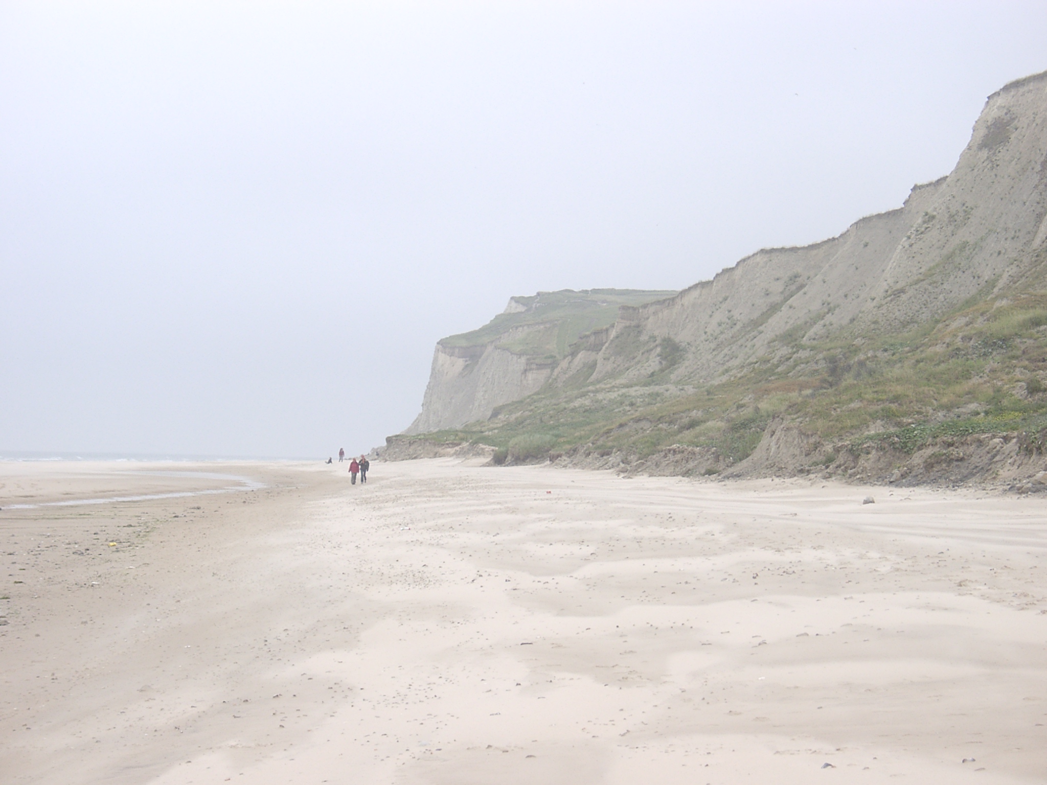
 x: 409242, y: 5642436. View west along the cliffs towards le Petit Blanc Nez showing the almost continuous cliff toe cover. |
 x: 409242, y: 5642436. Zoomed in view west along the cliffs towards le Petit Blanc Nez showing the almost continuous cliff toe cover. Note also the wave breaking over the innermost intertidal bar. |
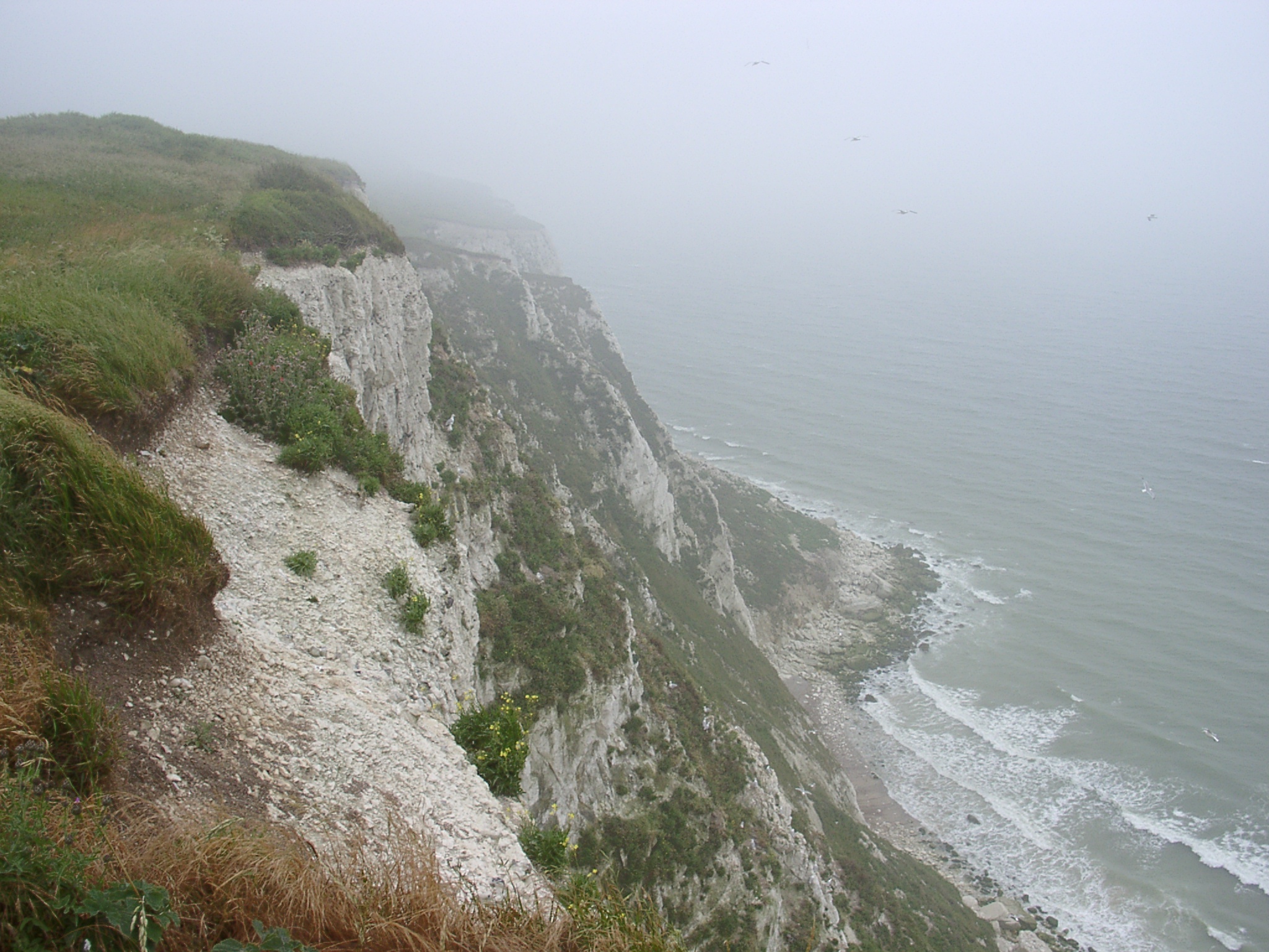
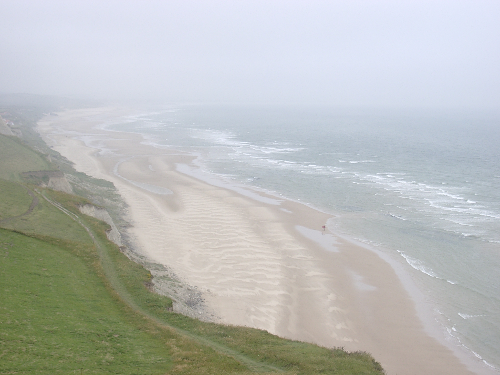
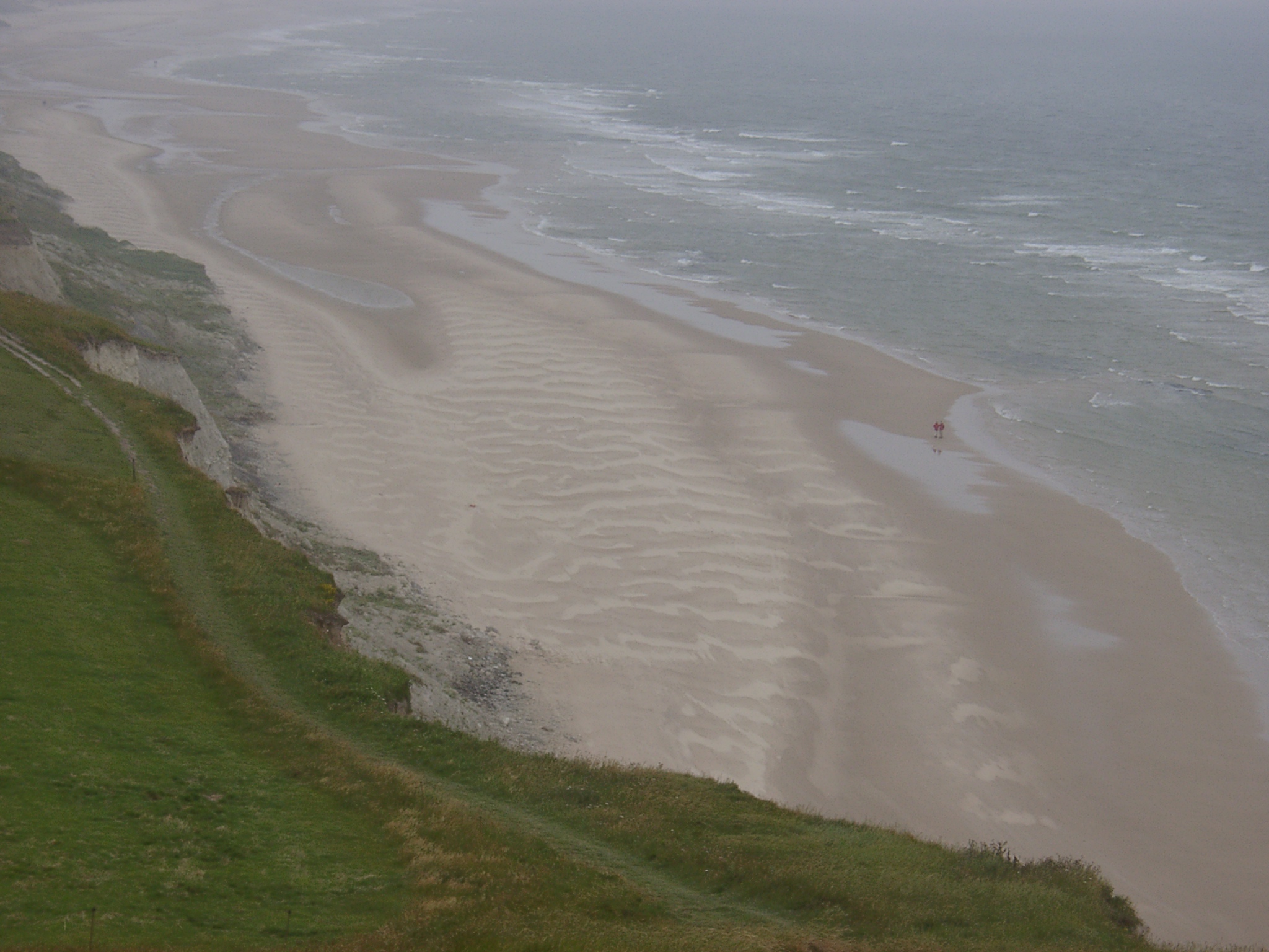
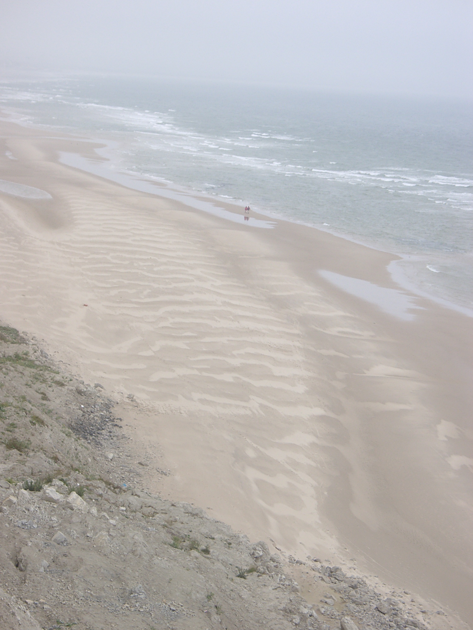
 x: 408264, y: 5641377. View east along the cliffs between le Petit Blanc Nez and Cap Balnc Nez showing the difference in the distance between the breaking waved and the cliff along this stretch. |
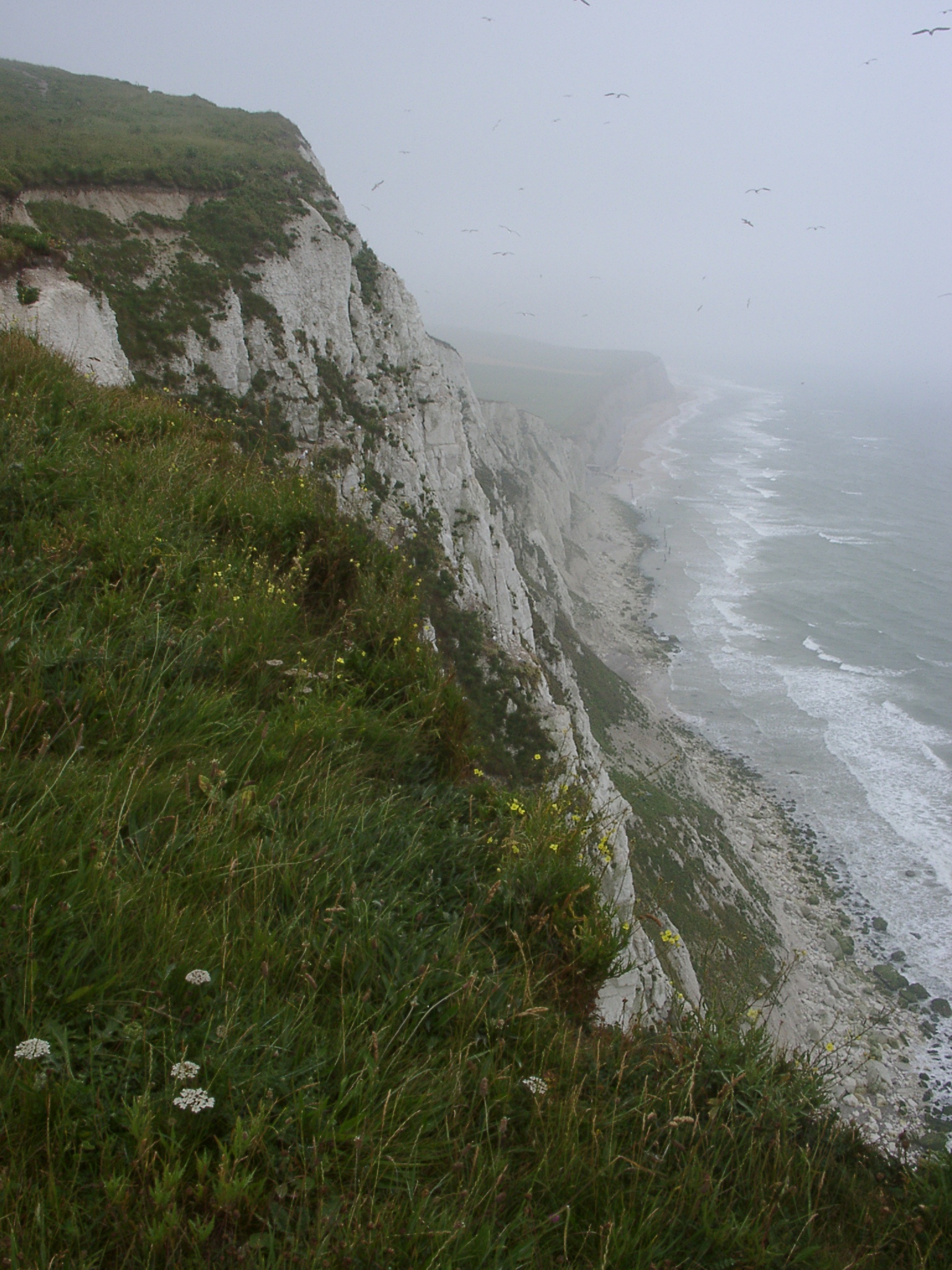
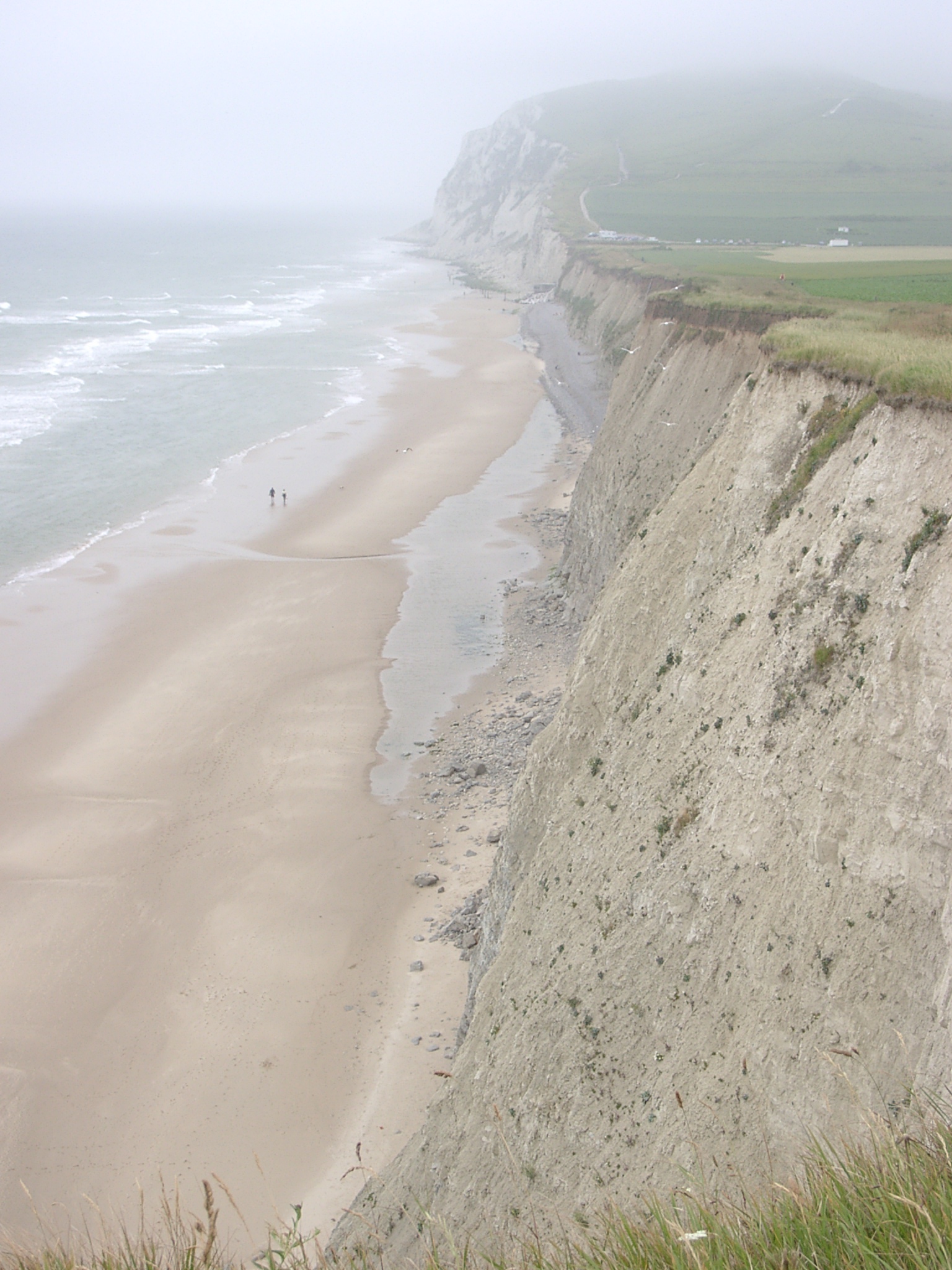
 x: 408059, y: 5641142. View west from le Petit Blanc Nez showing the more sand rich Baie de Wissant. The supratidal and higest subtidal area shows aeolian activity in response to westerly winds during the day and the preceding days. |
 x: 408059, y: 5641142. More detailed view west from le Petit Blanc Nez showing the more sand rich Baie de Wissant. The supratidal and higest subtidal area shows aeolian activity in response to westerly winds during the day and the preceding days. |
 x: 407832, y: 5640834. View west towards Le Petit Balnc Nez showing extensive flow and slumpt deposits in front of the cliffs that are eroded at the toe. |
 x: 407832, y: 5640834. View east along the cliff towards Le Petit Balnc Nez. Mainly slump and flow deposits that are actively eroded at the toe. |
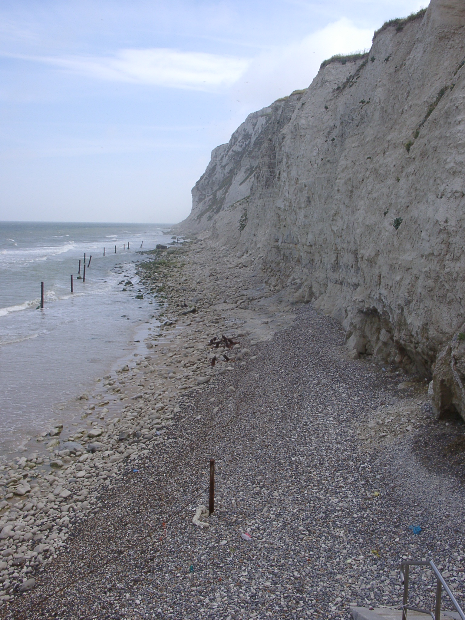
 x: 407483, y: 5640286. View east along the cliff top at the western end of the cliffs (access steps to the beach) with a 'sackung' scar of ~1m in the right hand part of the photo. |
 x: 407483, y: 5640286. View west along the covered / inactive cliff with a narrow shingle deposit at the toe. |
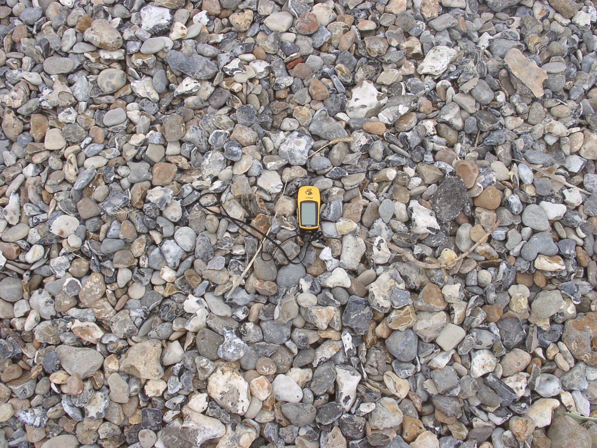 x: 407483, y: 5640286. Detail of the beach showing broken flints, flint nodules and iron stained flints. Few brown sandstone discs were seen (GPS length is 11cm). |
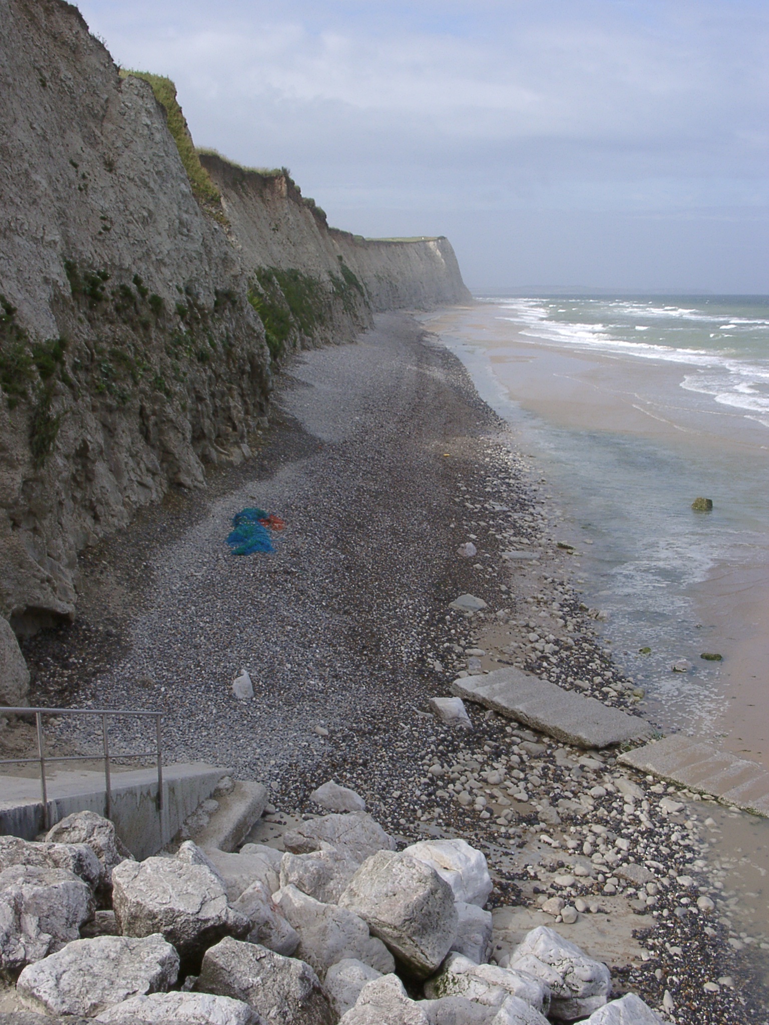
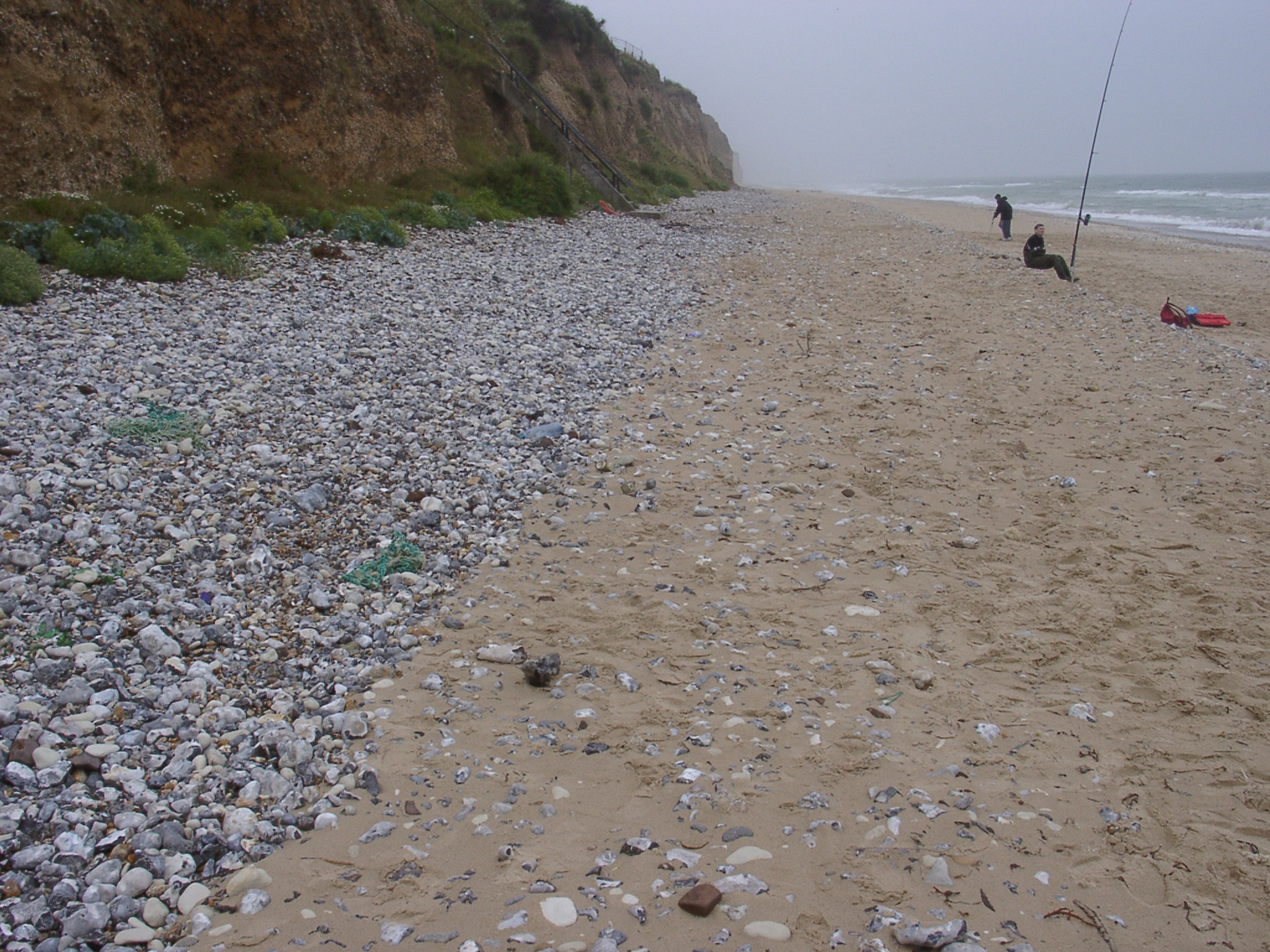
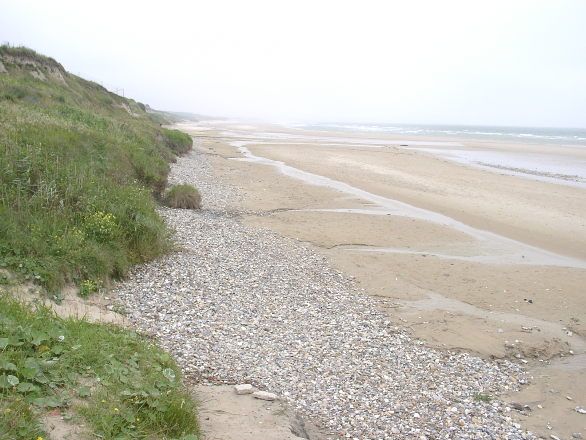
 x: 407543, y: 5640483. View east along the upper beach showing cliff toe deposits and their erosion. |
 x: 407543, y: 5640483. View of the cliffs showing some blocks sliding down the cliff face. People on top of the cliff for scale. |
 x: 407543, y: 5640483. Detail of material exposed in the eroding toe. |
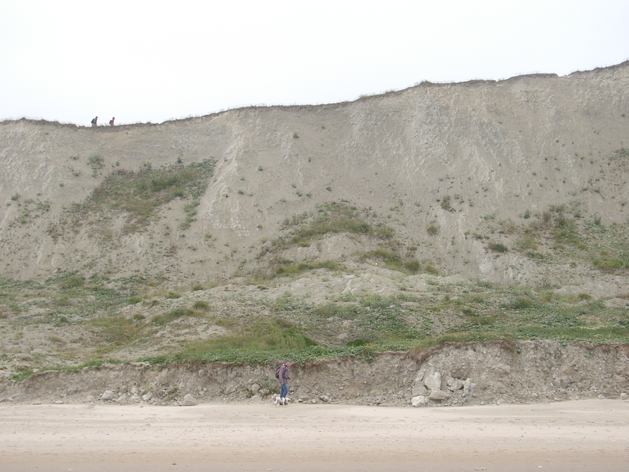 x: 407707, y: 5640777. View of the cliff showing increase in the cliff toe erosion and decrease in the amount of material protecting the cliffs. People at the toe and clif top for scale. |
 x: 407932, y: 5641108. View of the cliff showing transition from a covered beach to one without a beach toe deposit. Top of the cliff shows valley infill. |
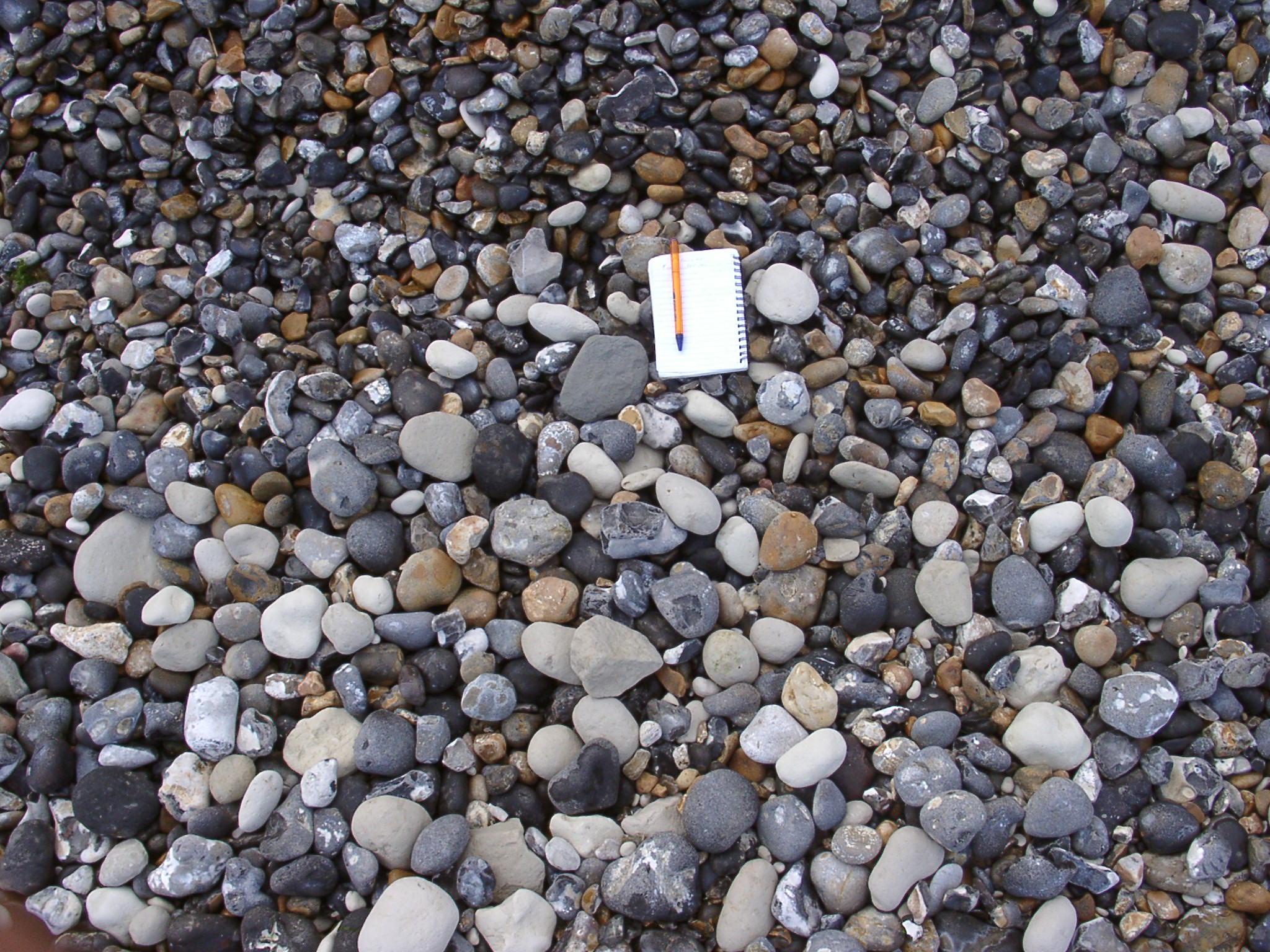
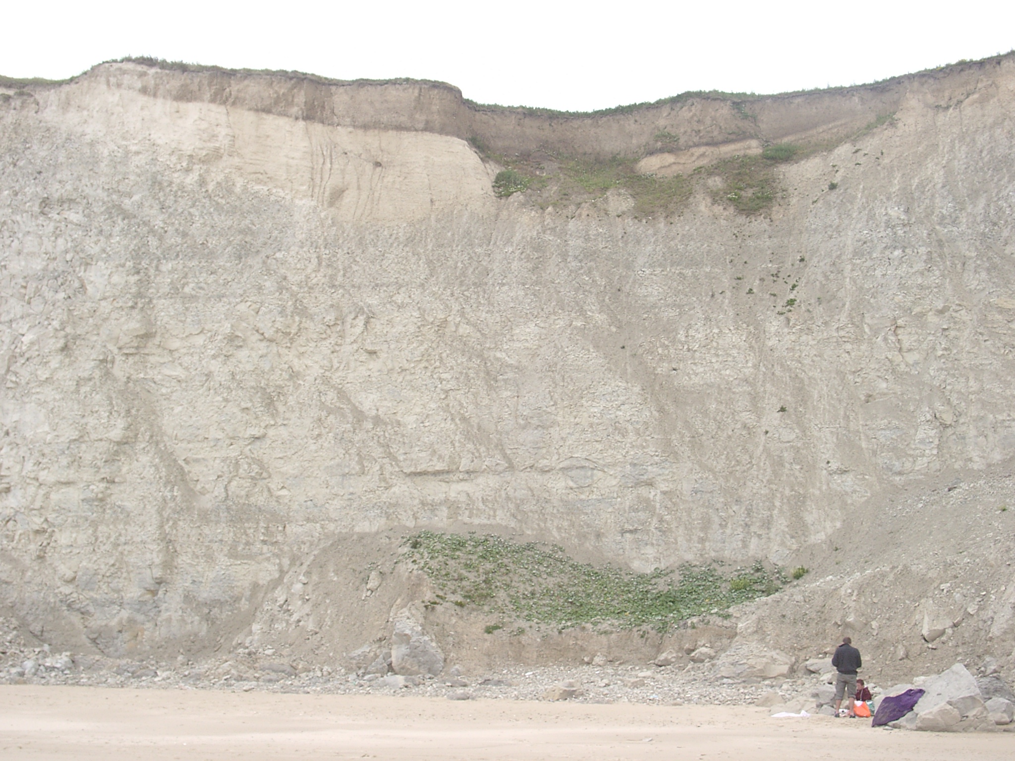
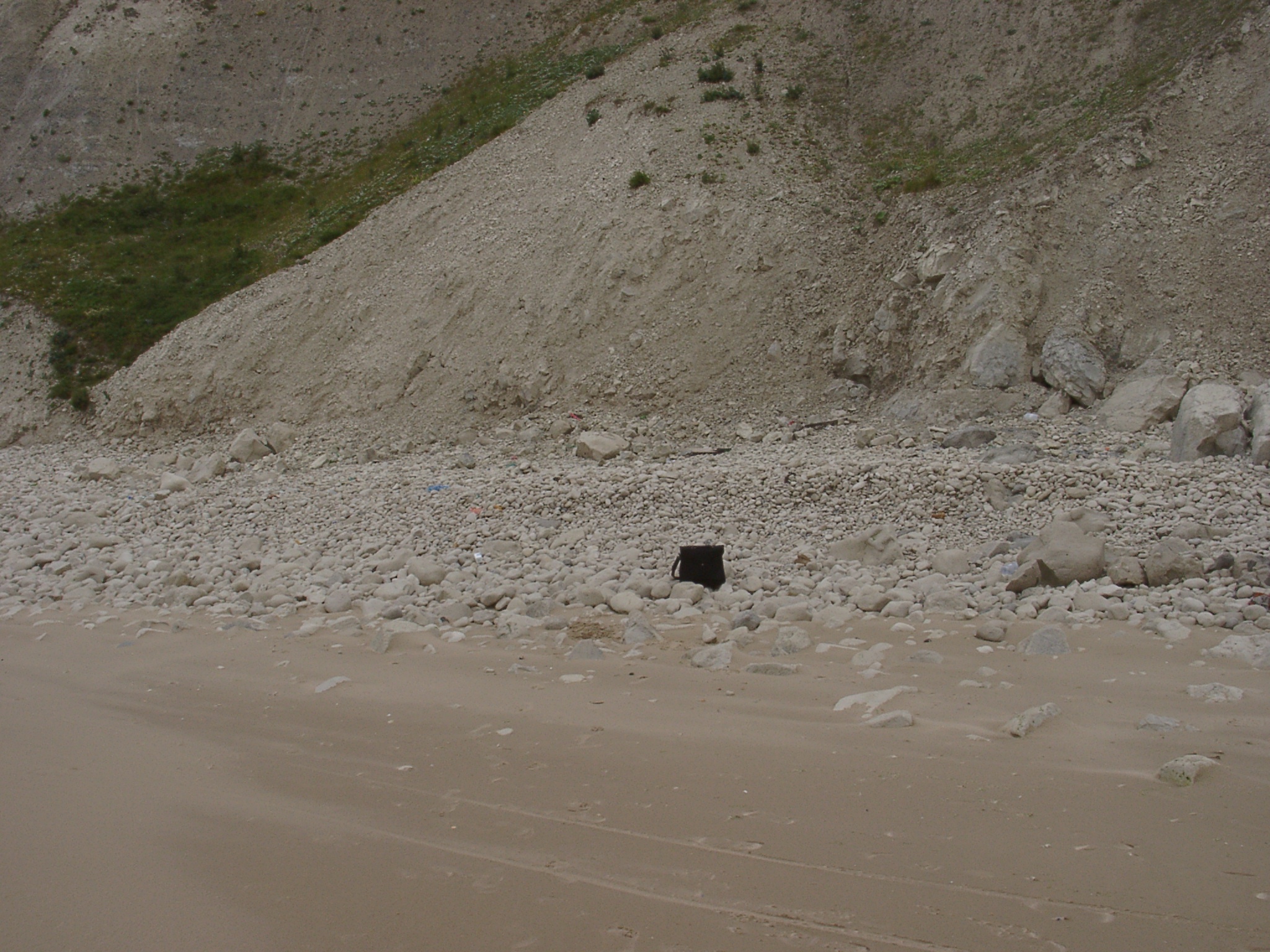 x: 408022, y: 5641184. View of chalk pebble storm berm. No other lithologies were visible at the surface. Height of balck bag is 40cm. |
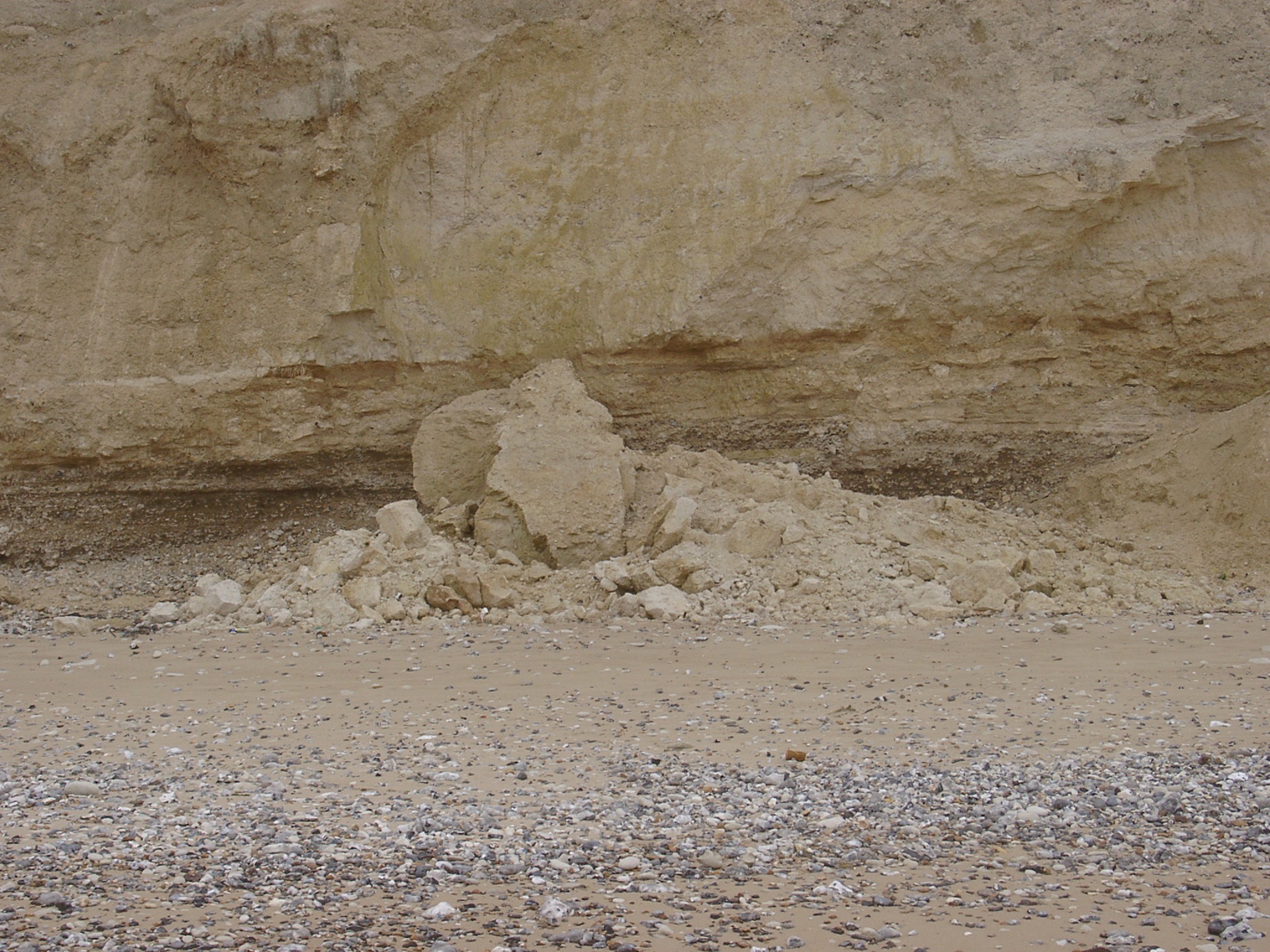
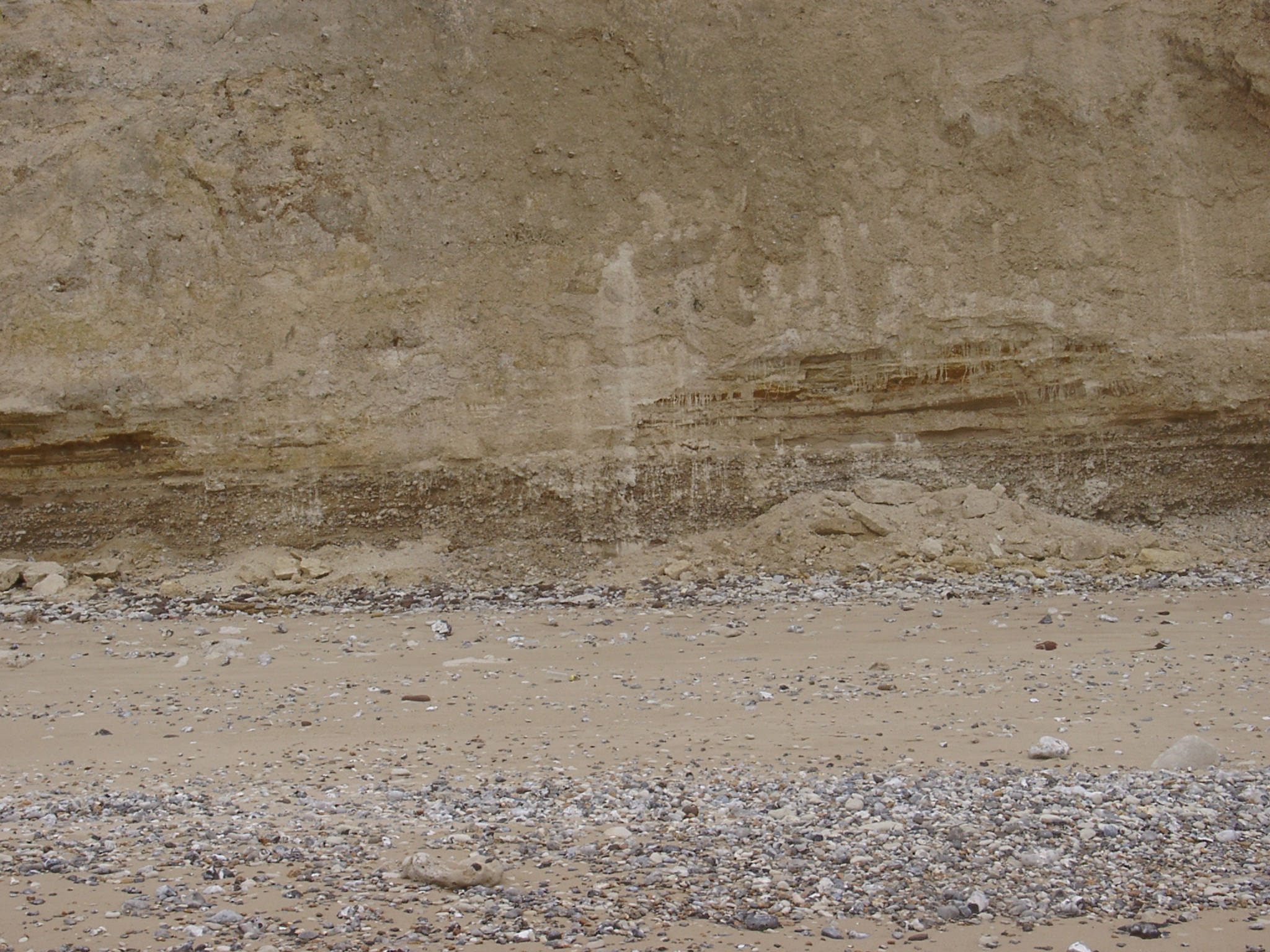
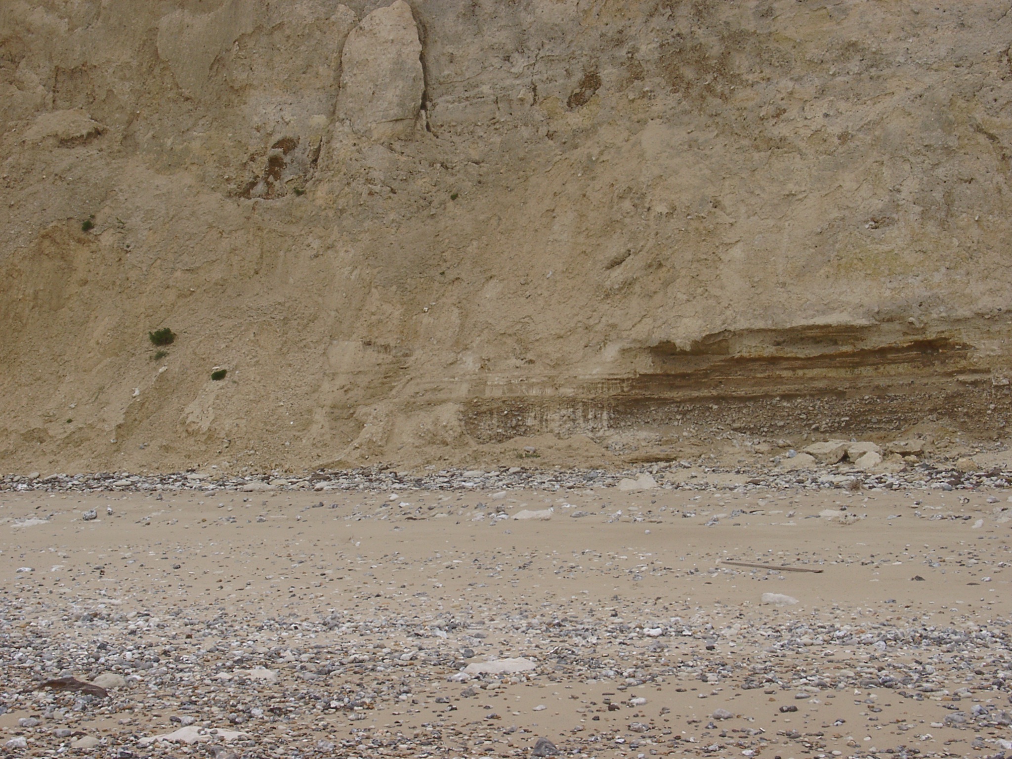
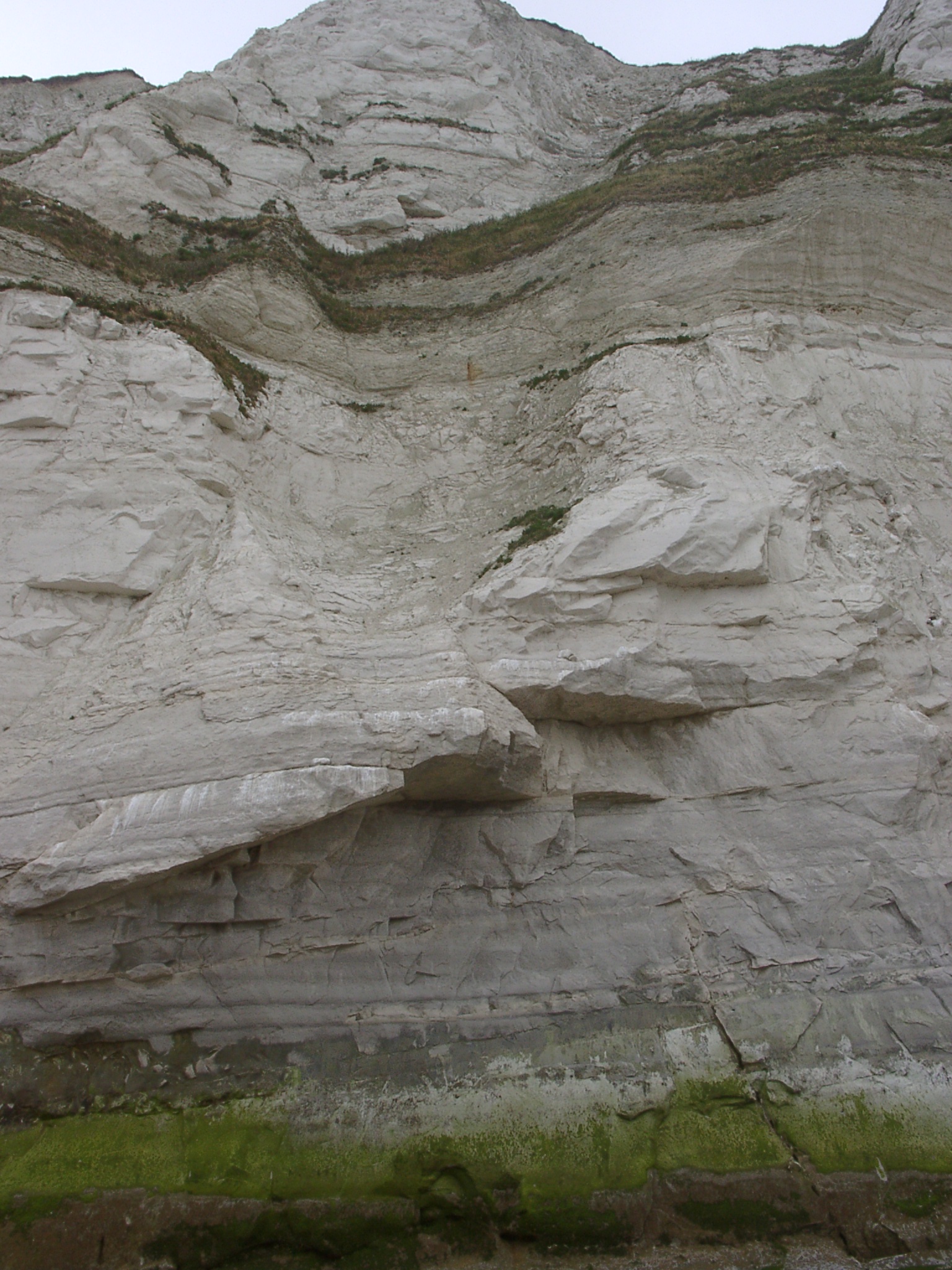 x: 409170, y: 5642453. Cliffs west of Cran d'Escalles between to major cliff falls, for a stretch of ~50m on either side no sediment found at the cliff toe. Chalk shows no presence of flint. |
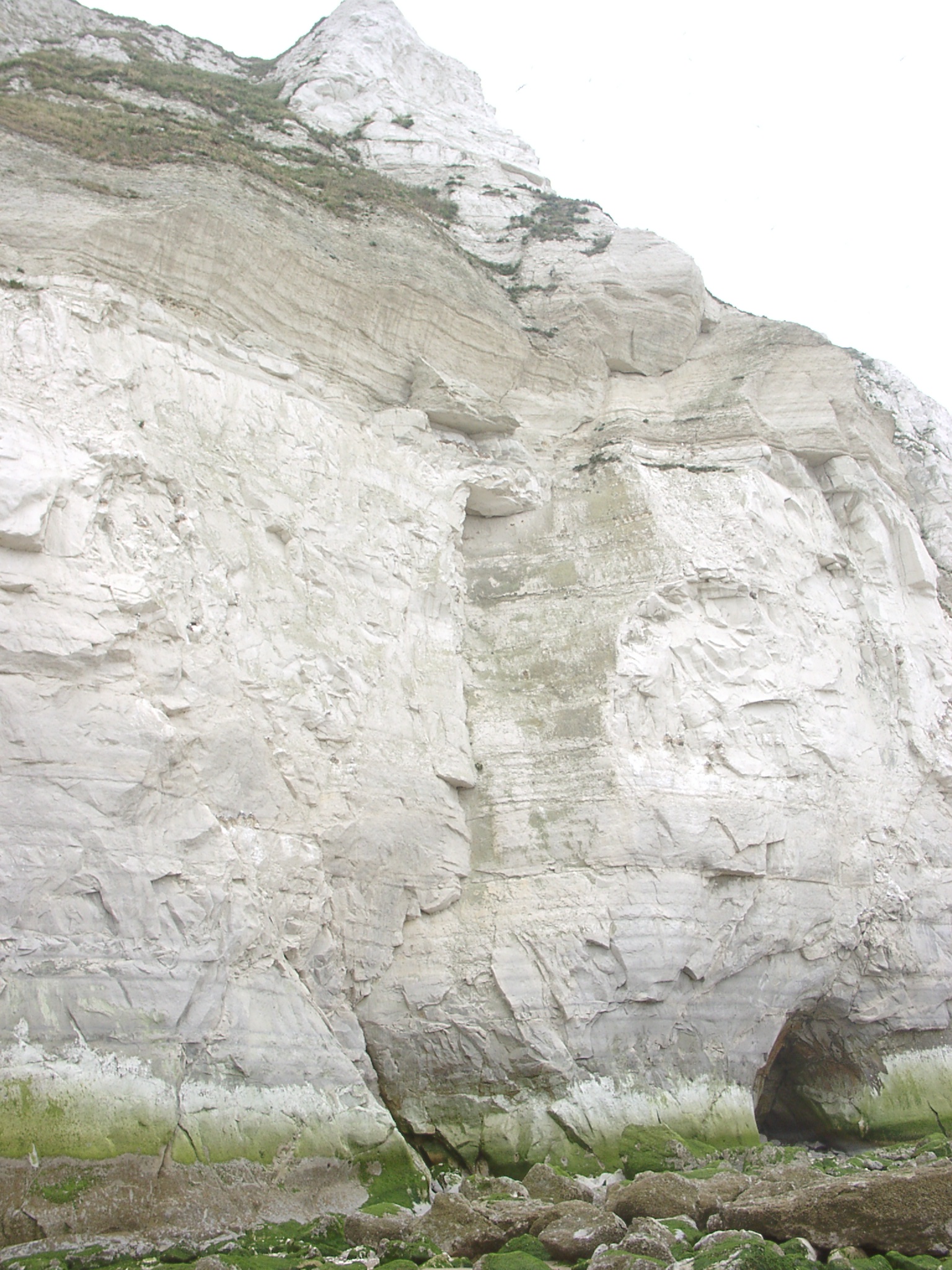 x: 409170, y: 5642453. Cliffs west of Cran d'Escalles between to major cliff falls, for a stretch of ~50m on either side no sediment found at the cliff toe. Chalk shows no presence of flint. |
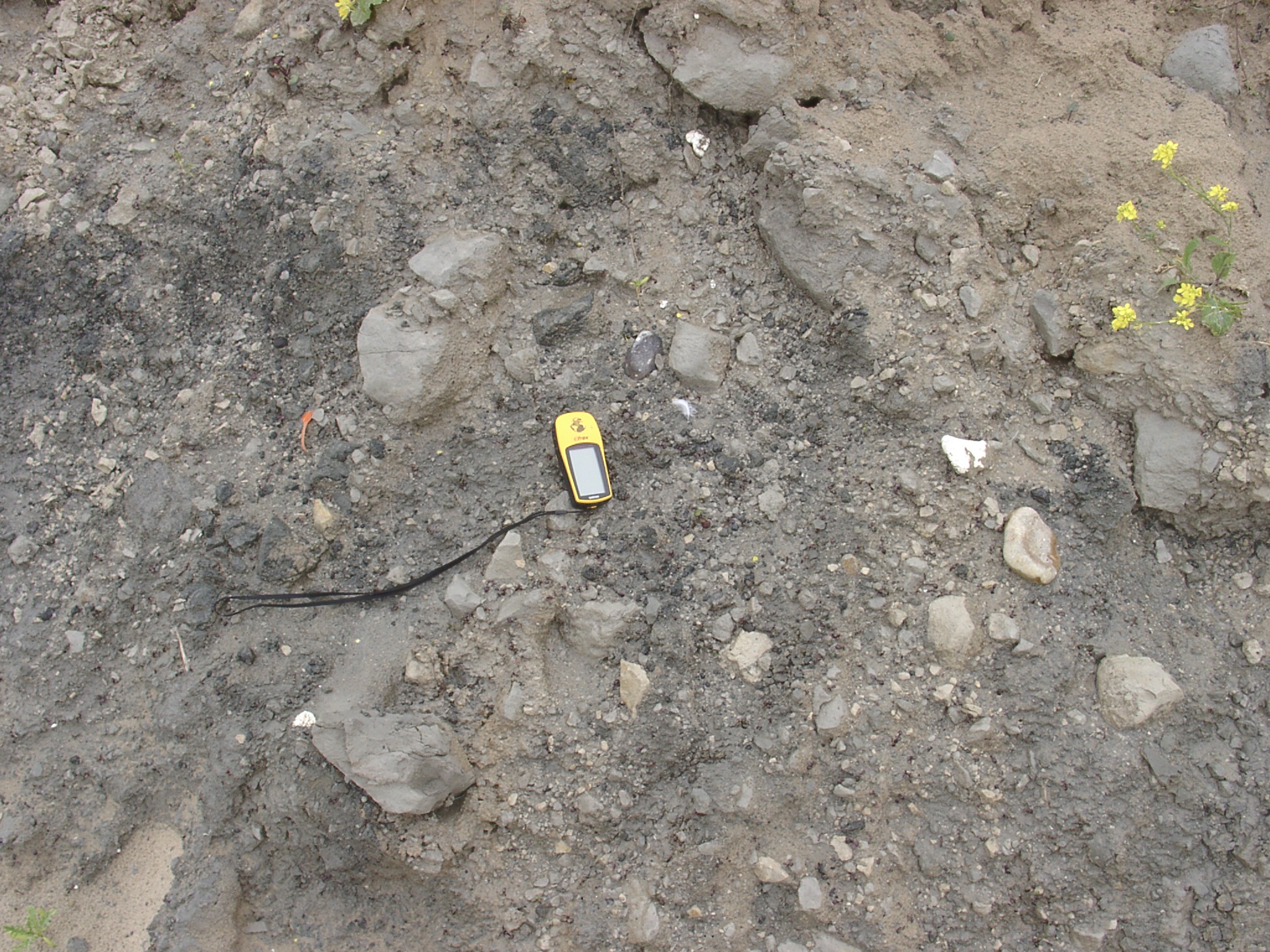
 x: 409407, y: 5642643. Beach material east of one of the larger cliff fall accumulations (GPS is 11cm long). |
 x: 409407, y: 5642643. Location of small beach east of one of the larger cliff falls. |
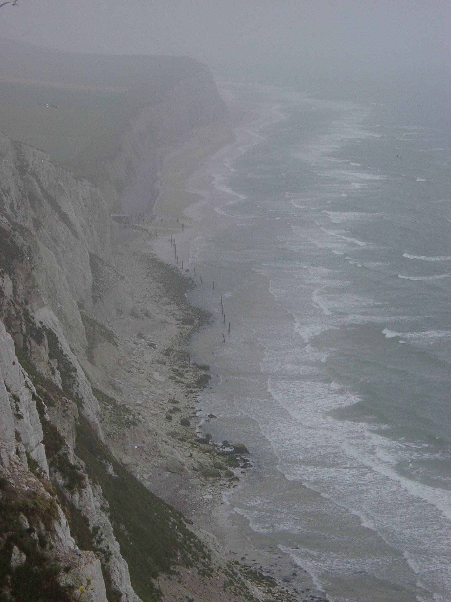
 x: 410442, y: 5643558. View eastwards along the cliffs to wards Sangatte. Chalk shore platform becomes exposed from the otherwise widespread sand cover. |
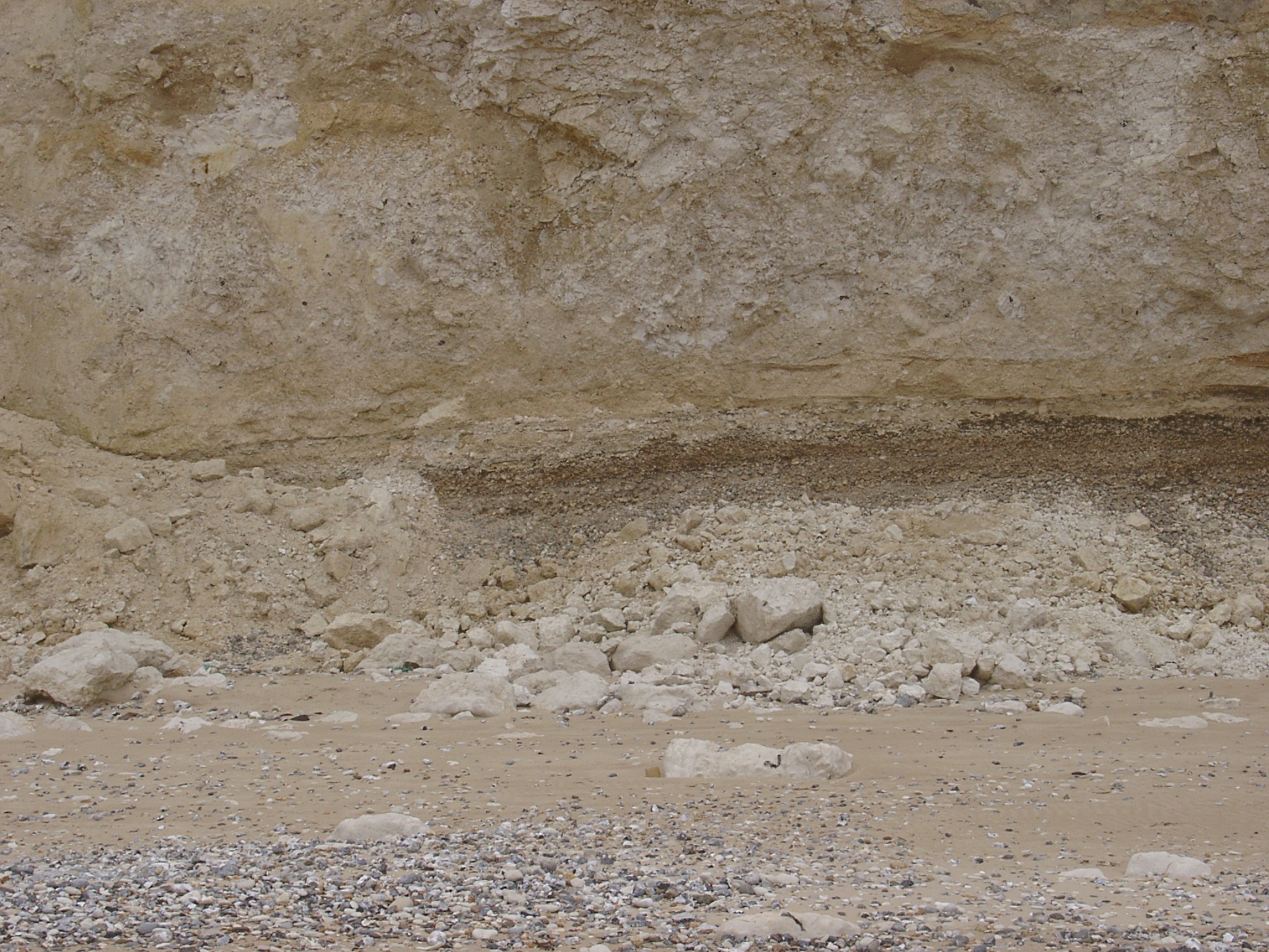
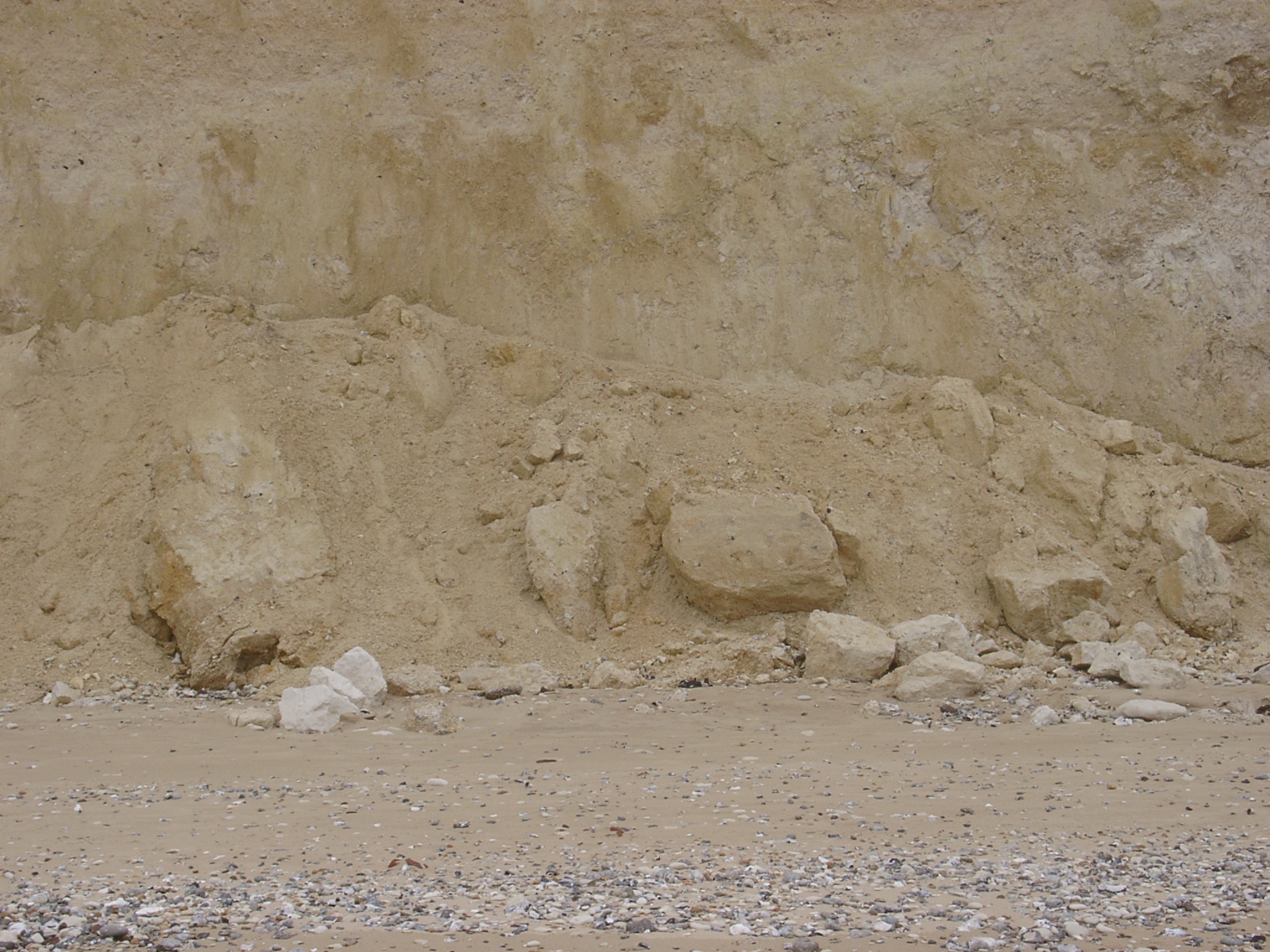
Panoramic view of the lower cliff between x 410685 / y 5643692 and x 410823 / y 5643789 showing the variation of the raised beach deposit over ~170m. |
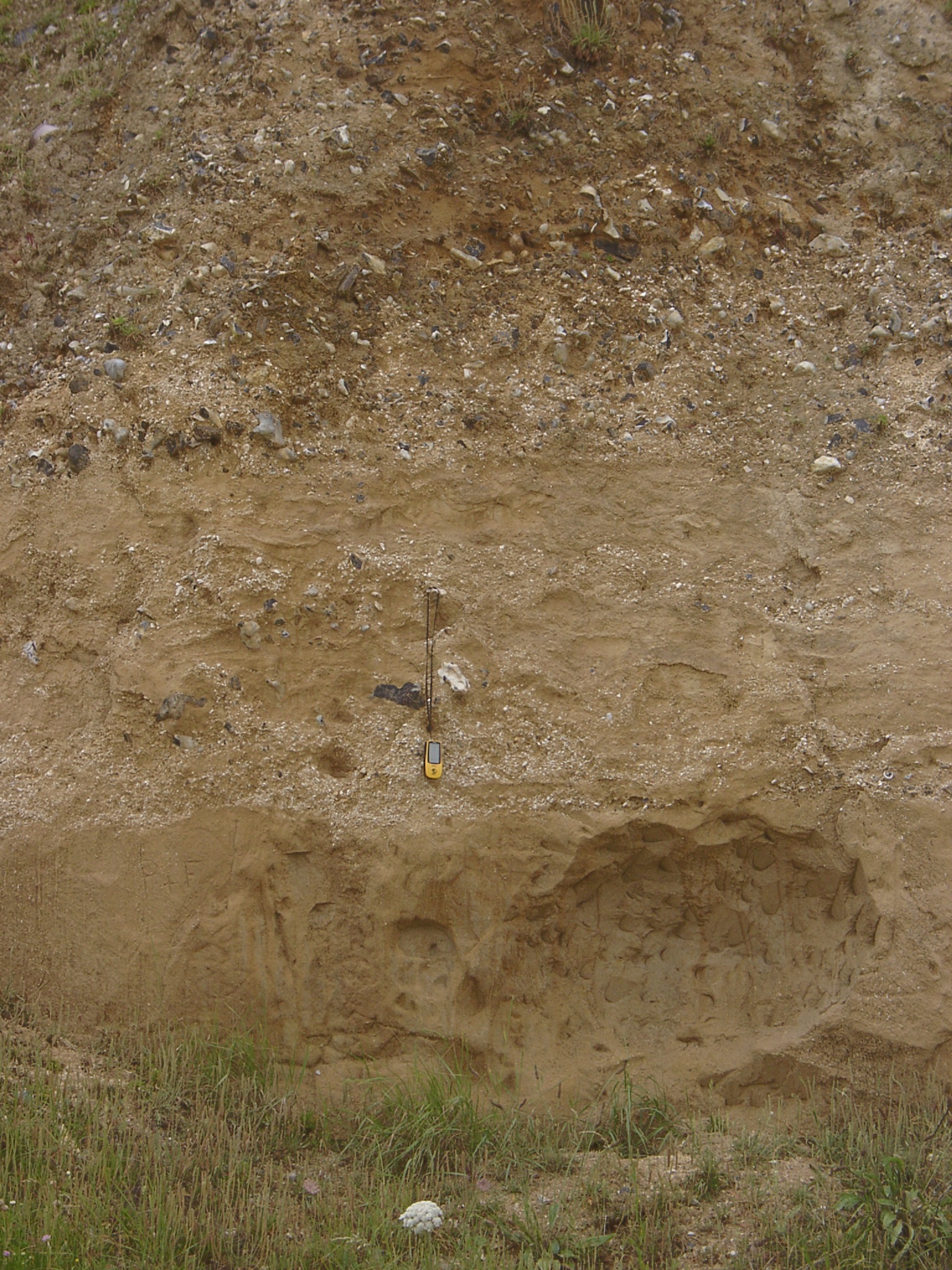
 x 410685 , y 5643692. Western end of the raised beach exposure. Bag in lower right is 0.4m high. |
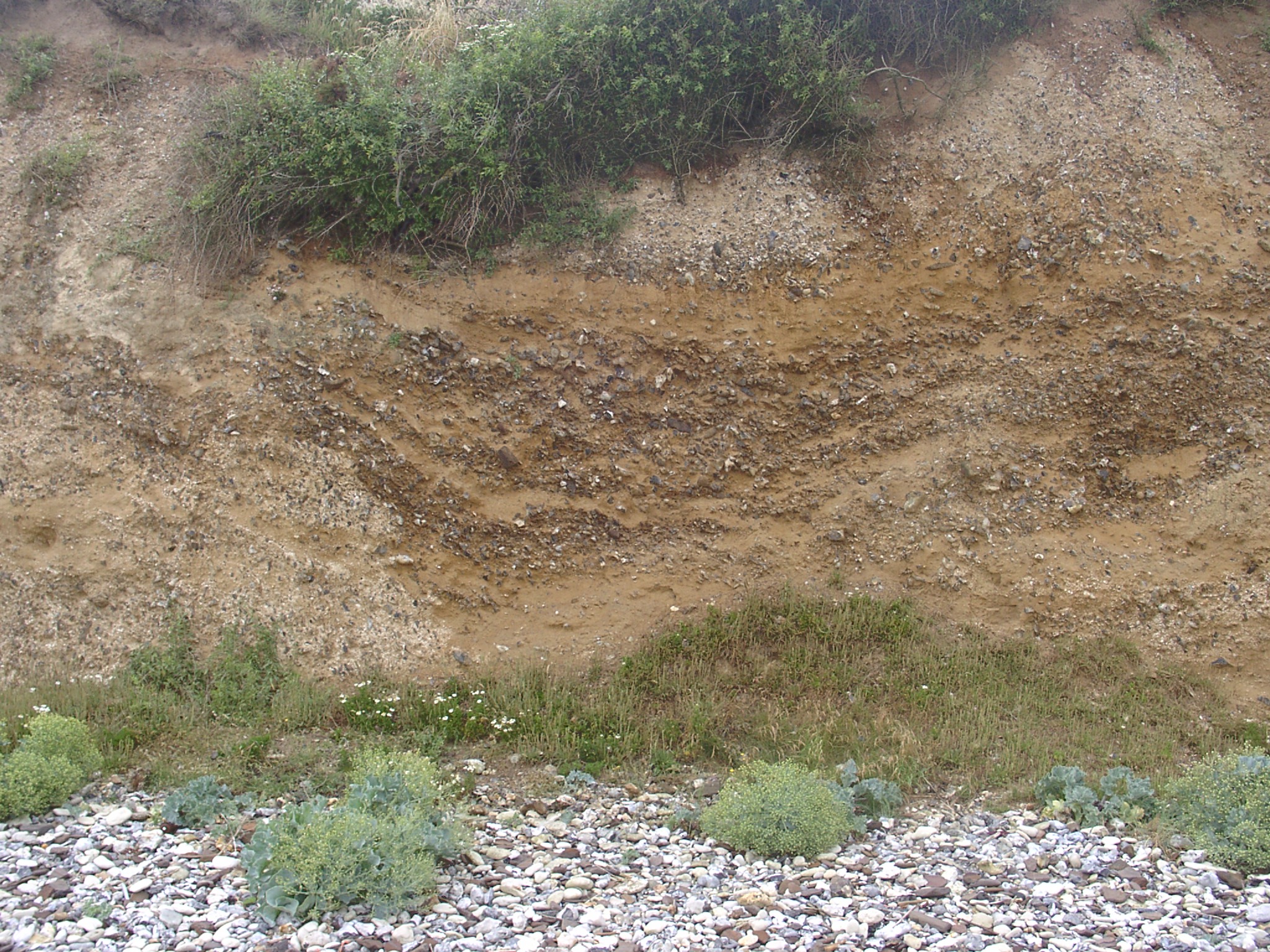
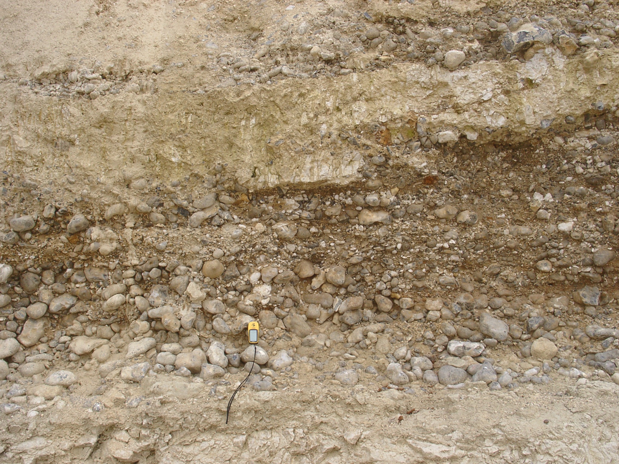
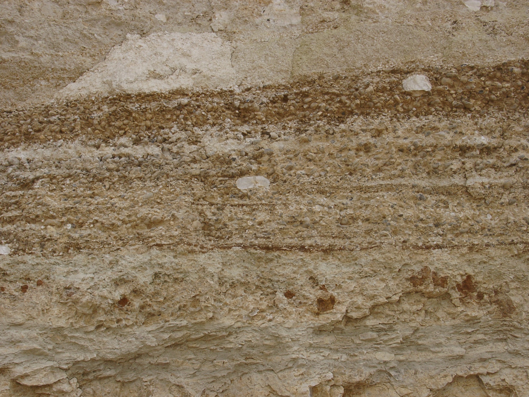
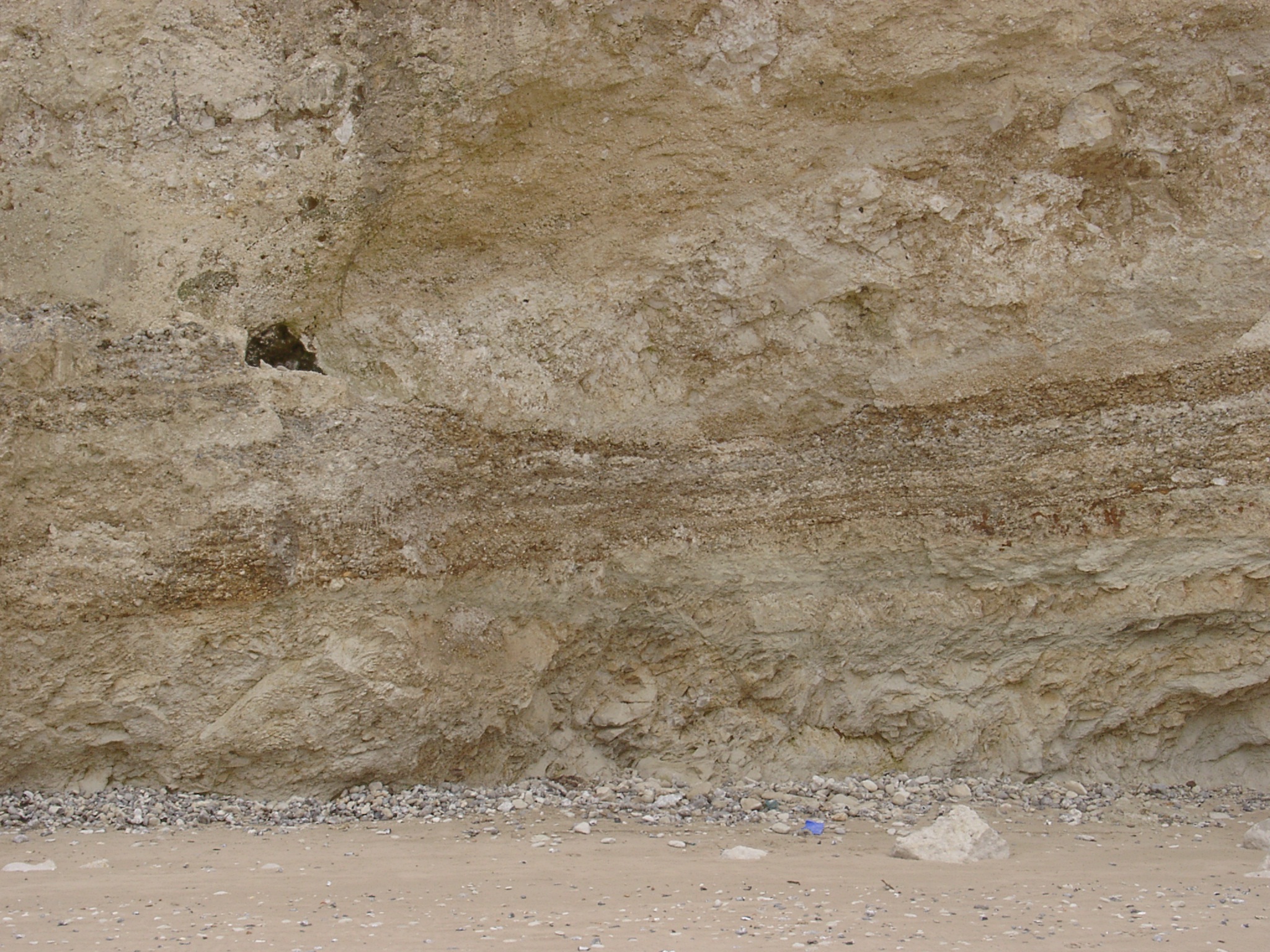 Detail of raised beach deposit |
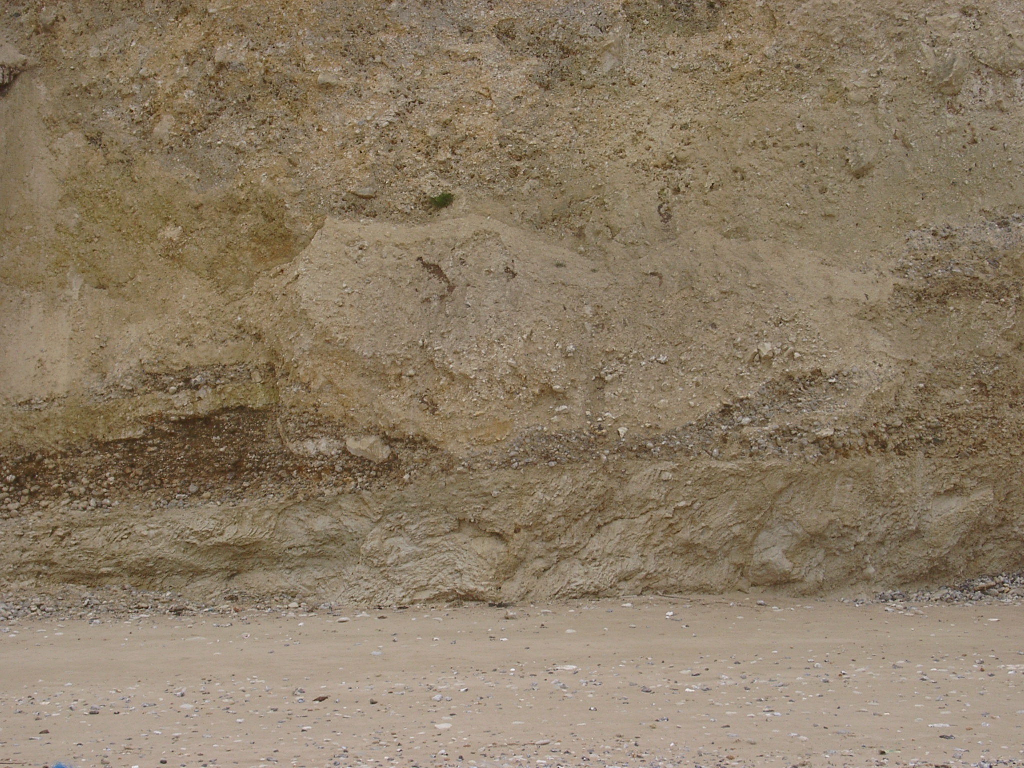 Detail of raised beach deposit |
 Detail of raised beach deposit |
 Detail of raised beach deposit |
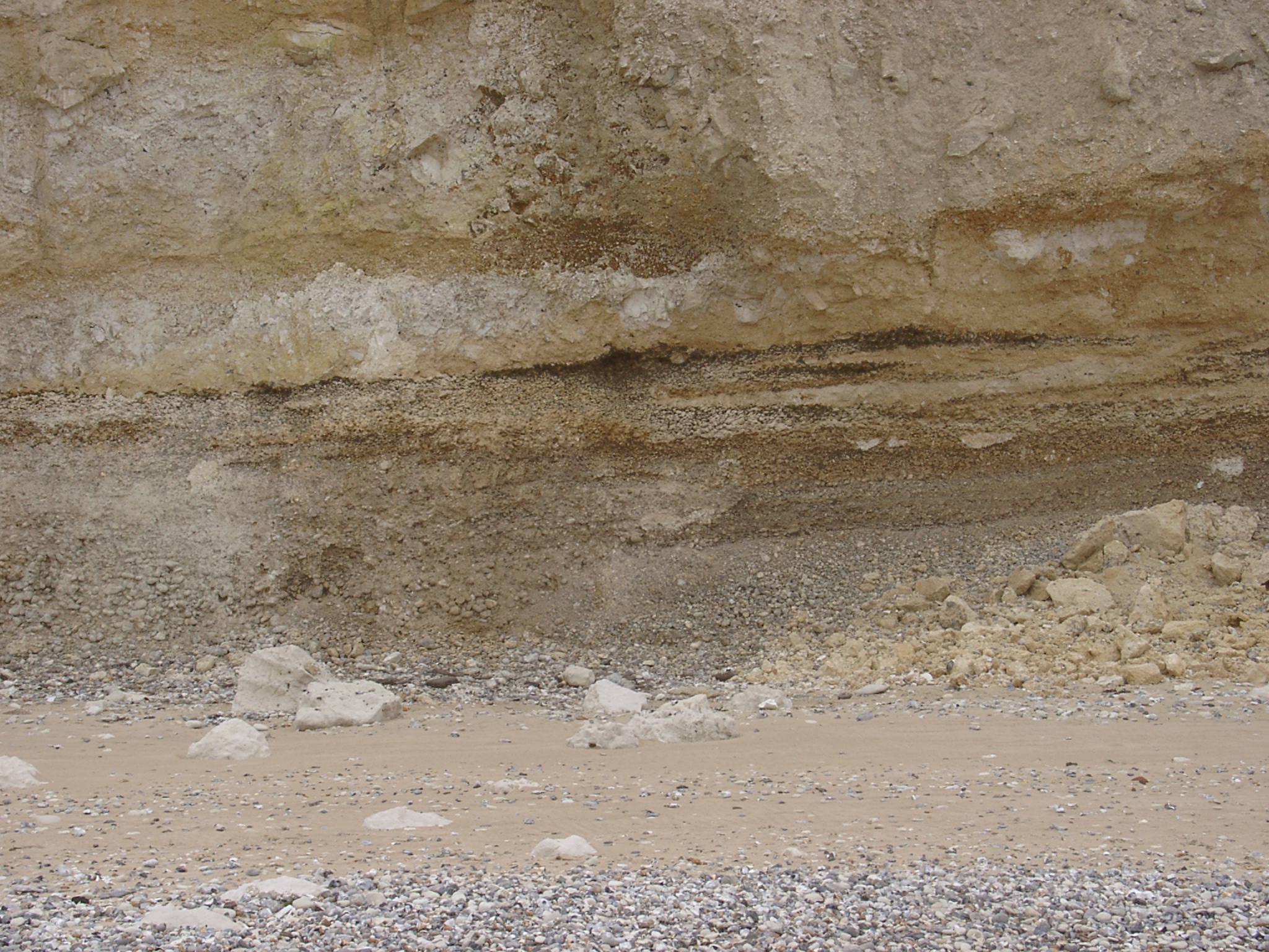 Detail of raised beach deposit |
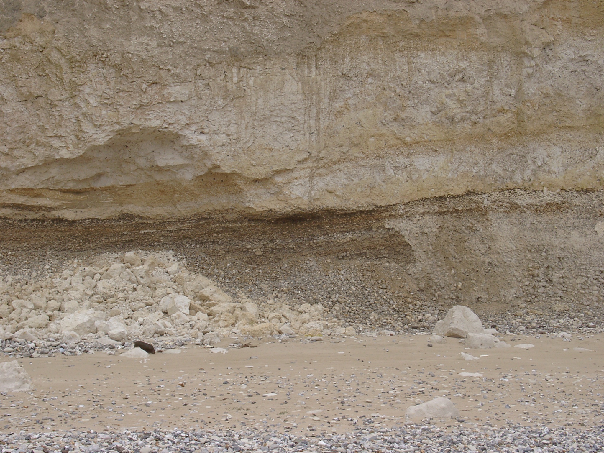 Detail of raised beach deposit |
 Detail of raised beach deposit |
 Detail of raised beach deposit (obliterated by slope deposit). |
 Detail of raised beach deposit |
 Detail of raised beach deposit |
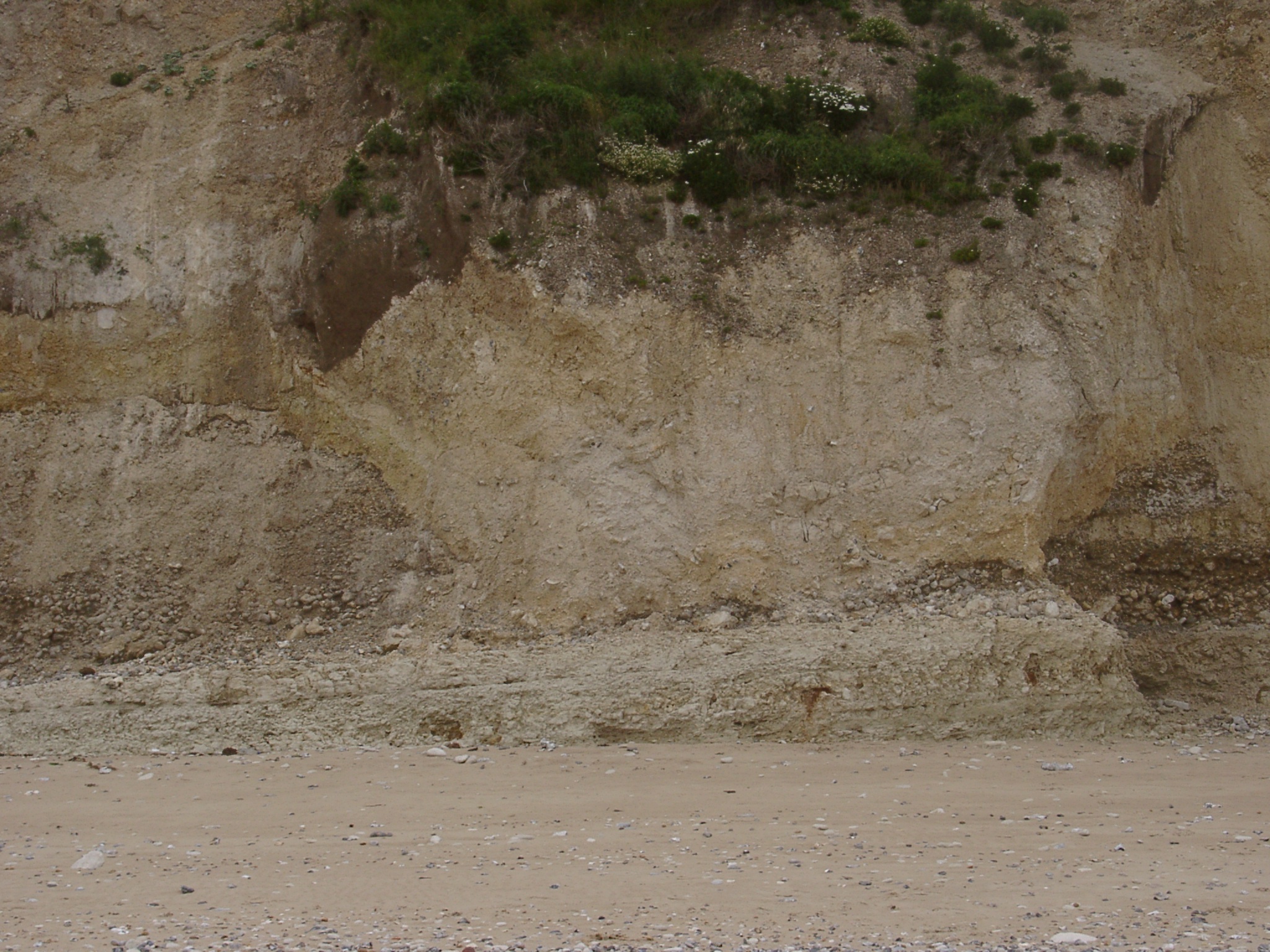
 x 410823 , y 5643789. Eastern end of the outcrop of the raised beach deposit where it disapperas under slope deposits. |
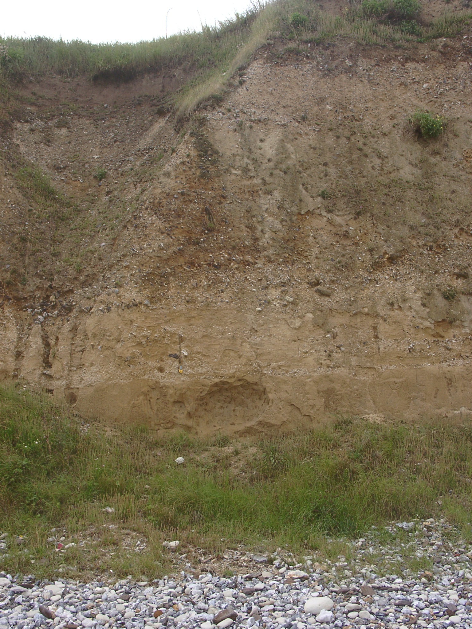
 Detailed section in the eastern part showing overlying sand layers. |
 Zoomed in: Detailed section in the eastern part showing overlying sand layers. |
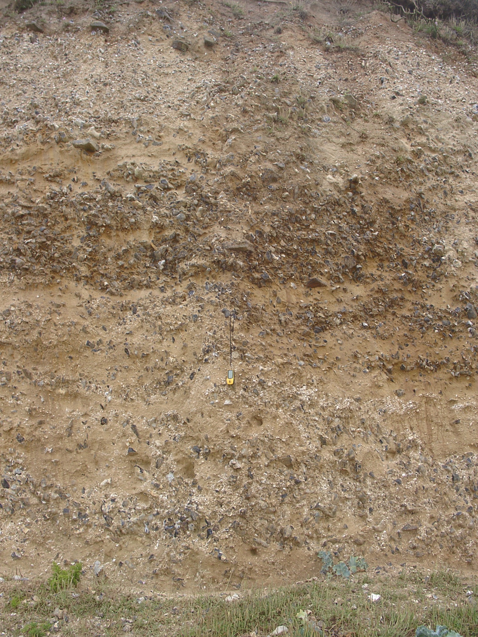
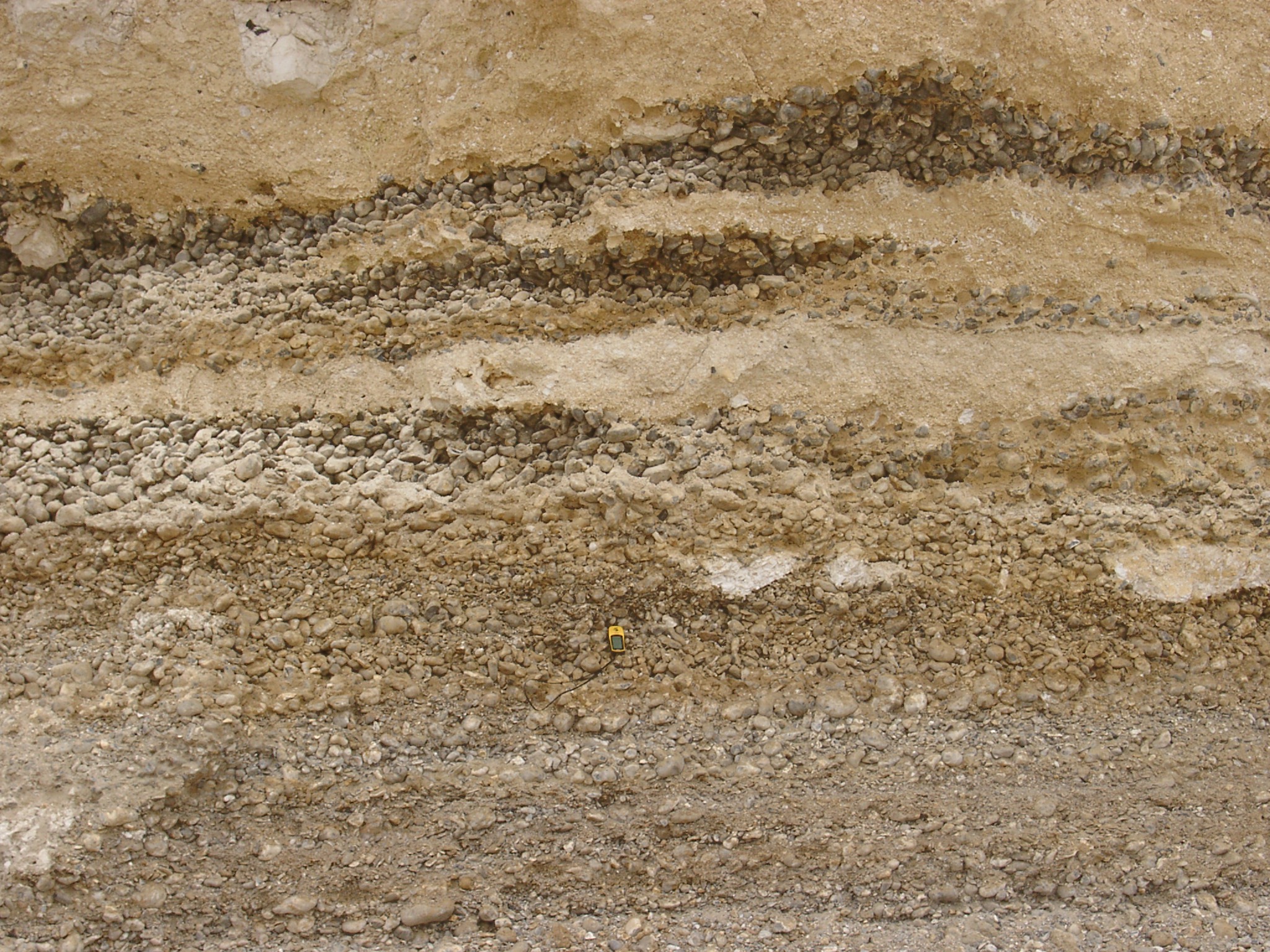
 Detailed section showing better cemented layers at the top and bottow and very unconsolidated layers in the middle. |
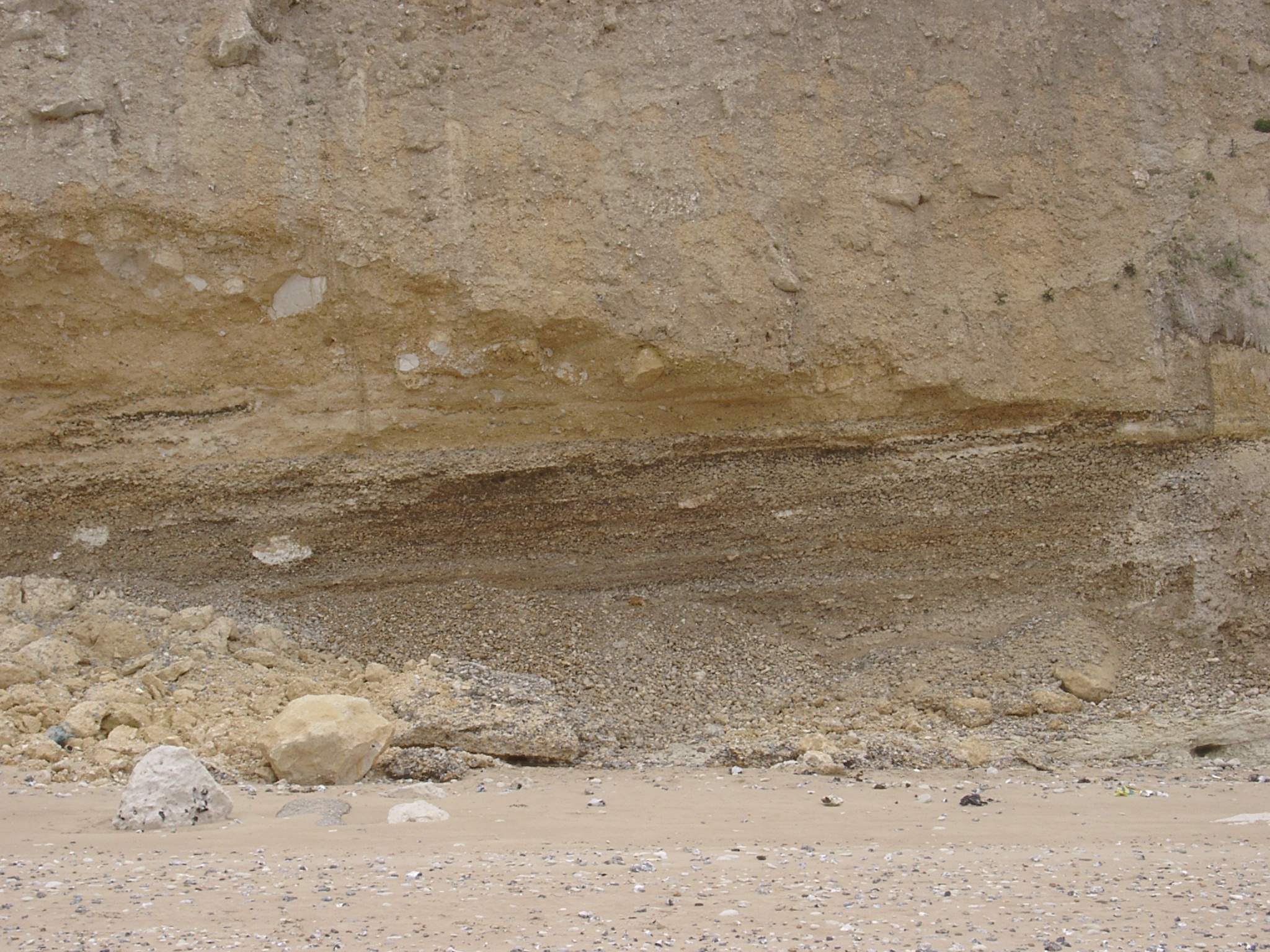
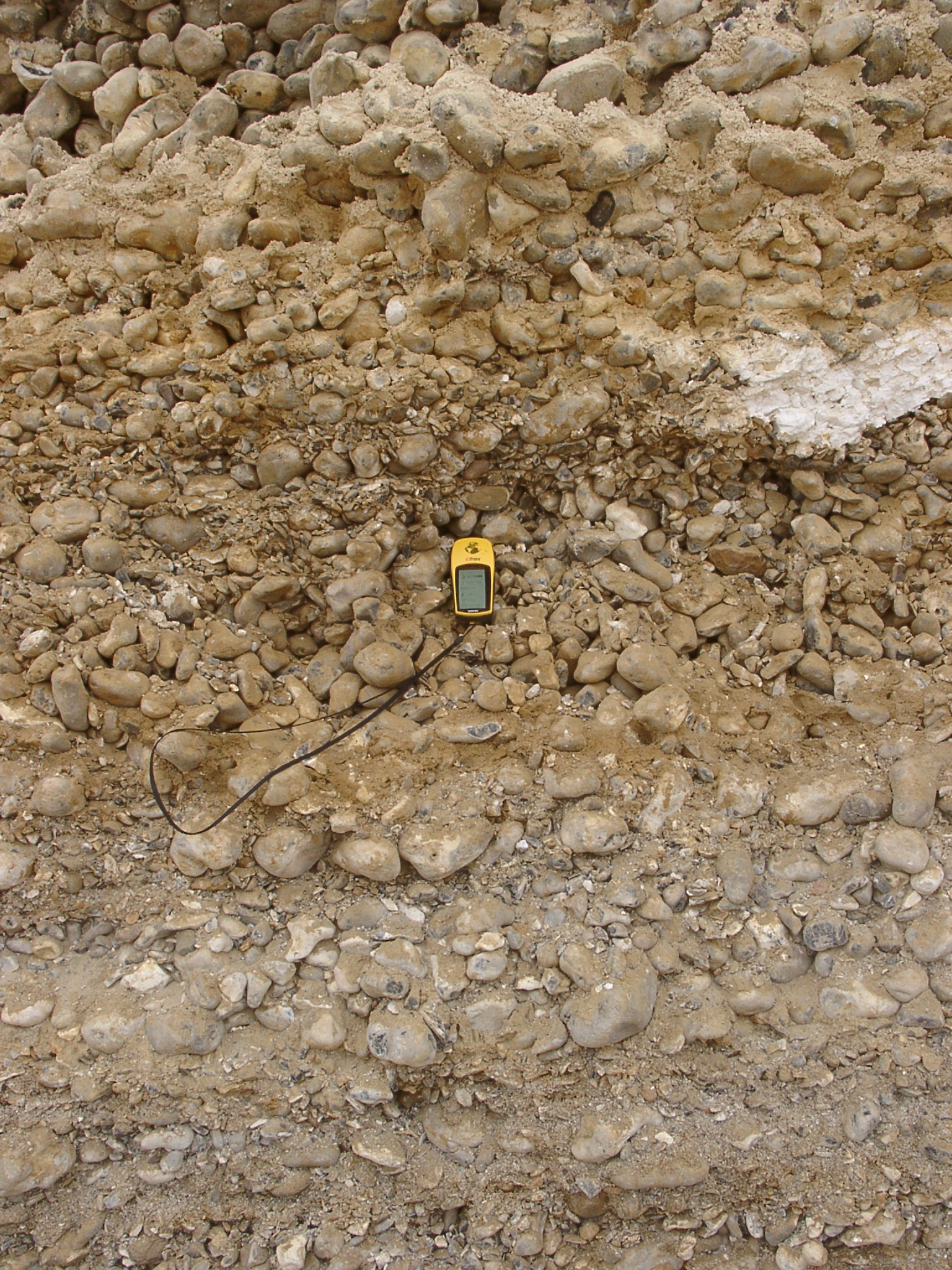
 Detailed section near the centre of the exposure showing interfingering of sand layers with almost pure gravel layers. |
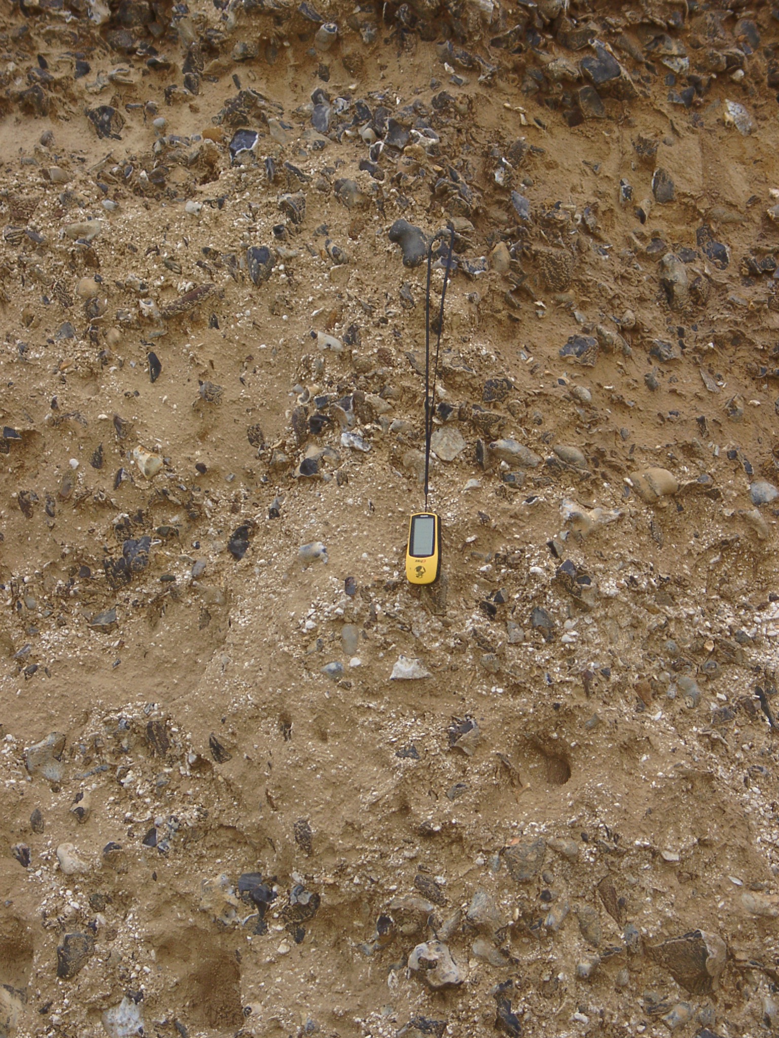
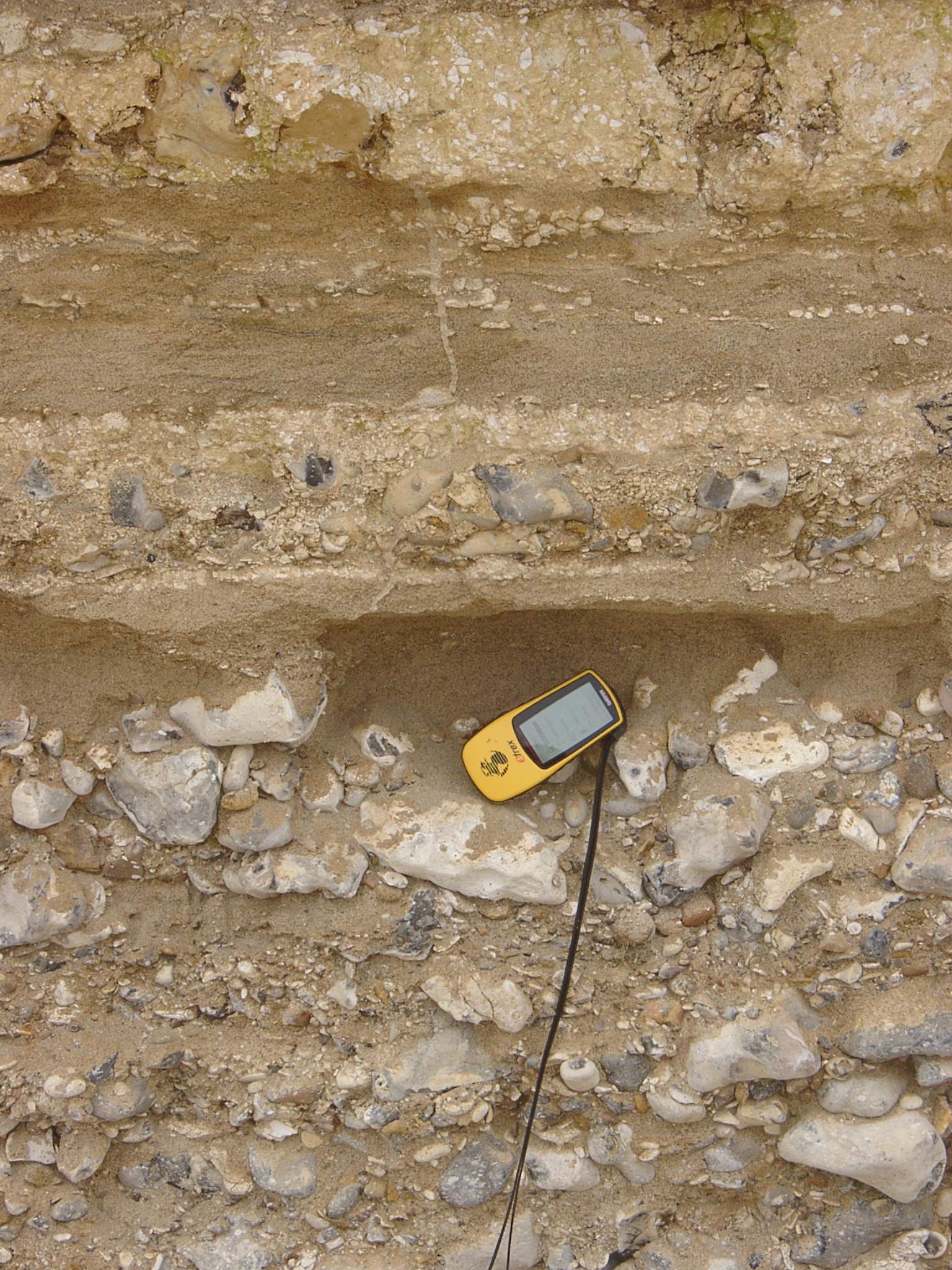
 Detailed section of the bottom contact. Coarsest clasts are found at the bottom (GPS is 11cm long) and are not cemented. |
 Detailed section of the upper part close to the western end of the exposure showing chalk block in coarse gravel. |
 x: 413193, y: 5644990: View west along the seawall at Sangatte. |
 x: 413193, y: 5644990: View east along the seawall at Sangatte. |
 x: 413193, y: 5644990: View east along the seawall at Sangatte. |